Park Narodowy Eurobodalla
| ||
 | ||
| park narodowy | ||
| Państwo | ||
|---|---|---|
| Data utworzenia | 1995 | |
| Powierzchnia | 29.13 km² | |
| Strona internetowa | ||
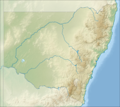
Park Narodowy Eurobodalla, (Eurobodalla National Park) – park narodowy położony w stanie Nowa Południowa Walia w Australii, około 270 km na południe od Sydney[1].
Przypisy
Media użyte na tej stronie
Shiny green button/marker widget.
Autor: , Licencja: CC BY-SA 3.0
Relief map of Australia, including the borders of the states of the Commonwealth of Australia
Autor: Tentotwo, Licencja: CC BY-SA 3.0
Relief location map of New South Wales, Australia Equidistant cylindrical projection, latitude of true scale 32.82° S (equivalent to equirectangular projection with N/S stretching 119 %). Geographic limits of the map:
- N: 27.9° S
- S: 37.8° S
- W: 140.6° E
- E: 153.9° E
Autor: Pete from NSW Far South Coast, Australia, Licencja: CC BY 2.0
This coastal freshwater lake is in Eurobodalla National Park just south of Narooma NSW. The line of trees in the top left are growing on sand dunes, with Fuller's Beach immediately behind.


