Port lotniczy Cardiff
| |||
(c) M J Richardson, CC BY-SA 2.0 | |||
| Państwo | |||
|---|---|---|---|
| Miejscowość | Rhoose | ||
| Typ | cywilne | ||
| Właściciel | Cardiff International Airport Ltd. | ||
| Kod IATA | CWL | ||
| Kod ICAO | EGFF | ||
| Wysokość | 67 m n.p.m. | ||
| Statystyki ruchu (2015[1]) | |||
| Liczba pasażerów | 1 160 506 | ||
| Liczba operacji | 25 077 | ||
| Drogi startowe | |||
| |||
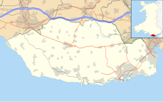
Położenie na mapie Vale of Glamorgan Contains Ordnance Survey data © Crown copyright and database right, CC BY-SA 3.0 | |||
Położenie na mapie Wielkiej Brytanii (c) Karte: NordNordWest, Lizenz: Creative Commons by-sa-3.0 de | |||
| Strona internetowa | |||
Port lotniczy Cardiff (IATA: CWL, ICAO: EGFF) – międzynarodowy port lotniczy położony w Rhoose, 19 km na południowy zachód od centrum Cardiff. Jest największym portem lotniczym w Walii. W 2007 obsłużył ponad 2 mln pasażerów.
Linie lotnicze i połączenia
| Linia lotnicza | Kierunek |
|---|---|
| BH Air | Sezonowo: |
| Citywing (obsługiwane przez Van Air Europe) | |
| Eastern Airways | |
| Eurowings | Sezonowe czartery: |
| Flybe |
Sezonowo: |
| Flybe (obsługiwane przez Blue Islands) | Sezonowo: |
| Iberia Express | Sezonowo: |
| KLM (obsługiwane przez KLM Cityhopper) | |
| Norwegian Air Shuttle | Sezonowe czartery: |
| Ryanair | Sezonowo:
|
| Thomas Cook Airlines | Sezonowo: |
| Thomas Cook Airlines (obsługiwane przez Avion Express) | Sezonowo: |
| TUI Airways | Sezonowo: |
| Vueling Airlines | Sezonowo: |
Przypisy
- ↑ Datasets | UK Civil Aviation Authority, www.caa.co.uk [dostęp 2017-11-26] (ang.).
- ↑ Flybe Timetable, www.flybe.com [dostęp 2017-11-26] (ang.).
- ↑ Iberia Express announces service to Spanish capital, www.cardiff-airport.com [dostęp 2017-11-26] (ang.).
Media użyte na tej stronie
(c) Karte: NordNordWest, Lizenz: Creative Commons by-sa-3.0 de
Location map of the United Kingdom
Icon representing an increase, consisting of a green-colored, up-pointing triangle.
Icon representing a decrease, consisting of a red-colored, down-pointing triangle.
Symbol lotniska do legendy mapy
Autor: Pedro A. Gracia Fajardo, escudo de Manual de Imagen Institucional de la Administración General del Estado, Licencja: CC0
Flaga Hiszpanii
Flag of Portugal, created by Columbano Bordalo Pinheiro (1857-1929), officially adopted by Portuguese government in June 30th 1911 (in use since about November 1910). Color shades matching the RGB values officially reccomended here. (PMS values should be used for direct ink or textile; CMYK for 4-color offset printing on paper; this is an image for screen display, RGB should be used.)
The flag of Navassa Island is simply the United States flag. It does not have a "local" flag or "unofficial" flag; it is an uninhabited island. The version with a profile view was based on Flags of the World and as a fictional design has no status warranting a place on any Wiki. It was made up by a random person with no connection to the island, it has never flown on the island, and it has never received any sort of recognition or validation by any authority. The person quoted on that page has no authority to bestow a flag, "unofficial" or otherwise, on the island.
Flag of Jamaica. “The sunshine, the land is green, and the people are strong and bold” is the symbolism of the colours of the flag. GOLD represents the natural wealth and beauty of sunlight; GREEN represents hope and agricultural resources; BLACK represents the strength and creativity of the people. The original symbolism, however, was "Hardships there are, but the land is green, and the sun shineth", where BLACK represented the hardships being faced.
Autor: NordNordWest, Licencja: CC BY-SA 3.0
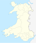
Location map of Wales, United Kingdom
Contains Ordnance Survey data © Crown copyright and database right, CC BY-SA 3.0
Blank map of the Vale of Glamorgan, UK with the following information shown:
- Administrative borders
- Coastline, lakes and rivers
- Roads and railways
- Urban areas
Equirectangular map projection on WGS 84 datum, with N/S stretched 160%
Geographic limits:
- West: 3.66W
- East: 3.15W
- North: 51.55N
- South: 51.35N


