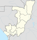
Port lotniczy Pointe-Noire
| Państwo | |||
|---|---|---|---|
| Miejscowość | |||
| Typ | cywilne | ||
| Kod IATA | PNR | ||
| Kod ICAO | FCPP | ||
| Wysokość | 17 m n.p.m. | ||
| Drogi startowe | |||
| |||
Port lotniczy Pointe-Noire – międzynarodowy port lotniczy położony w Pointe-Noire, w Republice Konga. Jest to drugi co do wielkości port lotniczy tego kraju.
Linie lotnicze i połączenia
| Linia Lotnicza | Kierunek |
|---|---|
| Air Côte d'Ivoire | |
| Air France | |
| ASKY Airlines | |
| Canadian Airways Congo | |
| CEIBA Intercontinental | |
| Equaflight | |
| Ethiopian Airlines | |
| Royal Air Maroc | |
| Trans Air Congo | |
| Turkish Airlines |
Przypisy
- ↑ • The African Aviation Tribune •: ► COTE D'IVOIRE: Air Côte d’Ivoire announces Pointe Noire, Ouagadougou, Yaounde; various timetable changes, www.theafricanaviationtribune.com [dostęp 2020-04-13].
- ↑ Asky Airlines plans Pointe Noire launch in July 2019 | Routesonline, www.routesonline.com [dostęp 2020-04-13] (ang.).
- ↑ Canadian Aiways Congo - Programme des vols, canaircongo.com [dostęp 2020-04-13] [zarchiwizowane z adresu 2014-09-04].
- ↑ Schedules & Fares from September 9th, 2016 - Equaflight Service, www.equaflight.com [dostęp 2020-04-13] [zarchiwizowane z adresu 2020-04-12] (ang.).
- ↑ Turkish Airlines adds Pointe Noire service from July 2019 | Routesonline, www.routesonline.com [dostęp 2020-04-13] (ang.).
Media użyte na tej stronie
Symbol lotniska do legendy mapy
Flag of the Ivory Coast, written by Jon Harald Søby, modified by Zscout370. The colors match to what is reported at http://fotw.vexillum.com/flags/ci.html.
The national flag of the Democratic Republic of the Congo. Created according to the 2006 constitution : Son emblème est le drapeau bleu ciel, orné d’une étoile jaune dans le coin supérieur gauche et traversé en biais d’une bande rouge finement encadrée de jaune. (Its symbol is a sky blue flag, decorated with a yellow star in the upper left corner and crossed in the diagonal by a red strip with thin yellow borders) It seems to be identical, except for a lighter field hue, to the 1966–1971 flag.
Flag of Ethiopia
Autor: User:Gvf, Licencja: CC BY 2.5
Location map of Congo. N 3.736, S -5.760, W 10.290, E 19.126


