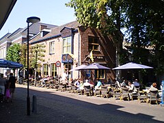
Putten
| |||||
 | |||||
| Państwo | |||||
| Prowincja | Geldria | ||||
| Burmistrz | Henk Lambooij (2014)[1] | ||||
| Powierzchnia | 87,41 km² | ||||
| Populacja (2014) • liczba ludności | 24 044 [2] | ||||
| Nr kierunkowy | 0341 | ||||
| Kod pocztowy | 3880–3882 | ||||
| Strona internetowa | |||||
Putten – gmina w prowincji Geldria w Holandii.
Miejscowości
Bijsteren, Diermen, Gerven, Halvinkhuizen, Hell, Hoef, Huinen, Huinerbroek, Huinerwal, Koudhoorn, Krachtighuizen, Putten (siedziba gminy), Steenenkamer, Veenhuizerveld.
Przypisy
- ↑ putten.nl: Burgeemester H. A. Lambooij (niderl.). [dostęp 2014-07-16].
- ↑ Aktualna liczba mieszkańców gminy (nl) [dostęp 12 lipca 2014]
Media użyte na tej stronie
Autor: Erik Frohne, Licencja: CC BY-SA 3.0
Location map of province Gelderland in the Netherlands
Equirectangular projection, N/S stretching 163 %. Geographic limits of the map:
- N: 52.522° N
- S: 51.731° N
- W: 4.989° E
- E: 6.834° E
Vlag gemeente Putten
Coat of arms of Putten (Netherlands).


