Reusel-De Mierden
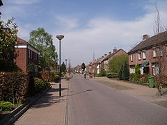
 Stolica gminy, Reusel | |||||
| |||||
| Państwo | |||||
|---|---|---|---|---|---|
| Prowincja | |||||
| Burmistrz | Harrie Tuerlings (2014)[1] | ||||
| Powierzchnia | 78,64 km² | ||||
| Populacja (2014) • liczba ludności • gęstość | 12 728[2] 163 os./km² | ||||
| Nr kierunkowy | 013, 0497 | ||||
| Kod pocztowy | 5094-5096, 5540, 5541 | ||||
| Strona internetowa | |||||
Reusel-De Mierden - gmina w prowincji Brabancja Północna w Holandii. Liczy sobie 12 728 mieszkańców (2014). Stolicą gminy jest miejscowość Reusel (8190 mieszk.). Oprócz niej na terytorium gminy leżą też: Hooge Mierde (1670 mieszk.), Hulsel (720 mieszk.), Lage Mierde (2000 mieszk.) i De Hoef.
Przez gminę przechodzą główne drogi N269 oraz N284. 11,5 km. od Reusel leży port lotniczy Eindhoven[3].
Przypisy
- ↑ reuseldemierden.nl: College van B&W (niderl.). [dostęp 2014-07-12]. [zarchiwizowane z tego adresu (2014-06-05)].
- ↑ Aktualna liczba mieszkańców miasta (nl) [dostęp 17 kwietnia 2014]
- ↑ Tripadvisor.com
Media użyte na tej stronie
Autor: fr:Utilisateur:Jeroen - User:Yerounn, Licencja: CC BY 2.5
Reusel (Netherlands)
Autor: Erik Frohne, Licencja: CC BY-SA 3.0
Location map of province North Brabant in the Netherlands
Equirectangular projection, N/S stretching 161 %. Geographic limits of the map:
- N: 51.90° N
- S: 51.20° N
- W: 4.10° E
- E: 6.10° E
Flag of municipality Reusel-De Mierden
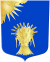
Coat of arms of the Dutch municipality of Reusel-De Mierden.


