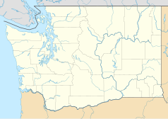
Robert Lang Studios
| Państwo | |
|---|---|
| Miejscowość | Shoreline |
| Typ budynku | studio nagraniowe, akademia |
| Właściciel | Robert Lang |
| Strona internetowa | |
Robert Lang Studios – amerykańskie studio nagraniowe mieszczące się w Shoreline w stanie Waszyngton, oddalonym dwanaście mil od Seattle. W studiu na przestrzeni lat nagrywało wielu artystów, w tym Alice in Chains, Bush, Candlebox, Foo Fighters i Nirvana.
Historia
Pod koniec stycznia 1994, zespół Nirvana nagrał w Robert Lang Studios swój ostatni studyjny utwór „You Know You’re Right”[1]. W 1994 członkowie Foo Fighters zarejestrowali w studiu debiutancki album (1995)[2]. Na przełomie września i października 1998 zespół Alice in Chains, przy współpracy producenta Toby’ego Wrighta, zarejestrował w studiu dwa premierowe utwory – „Get Born Again” i „Died”, podczas swojej ostatniej sesji z wokalistą Layne’em Staleyem[3]. Przy okazji rejestracji albumu Sonic Highways z 2014, grupa Foo Fighters powróciła do studia[4].
W 2016 studio zostało przekształcone w akademię dla młodych i aspirujących muzyków[4].
Przypisy
- ↑ Jacob McMurray: Taking Punk to the Masses: From Nowhere to Nevermind. Fantagraphics Books, 2011, s. 211. ISBN 978-1606994337. (ang.)
- ↑ Jeff Apter: The Dave Grohl Story. Music Sales Group, 2006, s. 256–260. ISBN 978-0-85712-021-2. (ang.)
- ↑ David de Sola: Alice in Chains: The Untold Story. Thomas Dunne Books, 2015, s. 277. ISBN 978-1250048073. (ang.)
- ↑ a b David Fazekas: Garage Geniuses: The Subterranean Recording Studio Where Nirvana Last Recorded (ang.). [dostęp 2017-04-11]. [zarchiwizowane z tego adresu (2017-04-11)].
Linki zewnętrzne
- Oficjalna strona (ang.)
Media użyte na tej stronie
Autor: Alexrk2, Licencja: CC BY 3.0
Ta mapa została stworzona za pomocą GeoTools.
Autor: Uwe Dedering, Licencja: CC BY-SA 3.0
Location map of the USA (without Hawaii and Alaska).
EquiDistantConicProjection:
Central parallel:
* N: 37.0° N
Central meridian:
* E: 96.0° W
Standard parallels:
* 1: 32.0° N
* 2: 42.0° N
Made with Natural Earth. Free vector and raster map data @ naturalearthdata.com.
Formulas for x and y:
x = 50.0 + 124.03149777329222 * ((1.9694462586094064-({{{2}}}* pi / 180))
      * sin(0.6010514667026994 * ({{{3}}} + 96) * pi / 180))
y = 50.0 + 1.6155950752393982 * 124.03149777329222 * 0.02613325650382181
      - 1.6155950752393982  * 124.03149777329222 *
     (1.3236744353715044  - (1.9694462586094064-({{{2}}}* pi / 180))
      * cos(0.6010514667026994 * ({{{3}}} + 96) * pi / 180))
The flag of Navassa Island is simply the United States flag. It does not have a "local" flag or "unofficial" flag; it is an uninhabited island. The version with a profile view was based on Flags of the World and as a fictional design has no status warranting a place on any Wiki. It was made up by a random person with no connection to the island, it has never flown on the island, and it has never received any sort of recognition or validation by any authority. The person quoted on that page has no authority to bestow a flag, "unofficial" or otherwise, on the island.
Autor: Alexrk2, Licencja: CC BY 3.0
Ta mapa została stworzona za pomocą GeoTools.


