Rock River (rzeka)
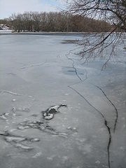
 Zamarznięta rzeka Rock River | |
| Kontynent | Ameryka Północna |
|---|---|
| Państwo | |
| Rzeka | |
| Długość | 481[1] km |
| Powierzchnia zlewni | 9193,79 km² |
| Średni przepływ | 175,4[2] m³/s Joslin, Illinois |
| Źródło | |
| Miejsce | Horicon Marsh, Hrabstwo Dodge, Wisconsin |
| Współrzędne | 43°28′26″N 88°38′41″W/43,473889 -88,644722 |
| Ujście | |
| Recypient | Missisipi |
| Miejsce | Rock Island |
| Wysokość | 168[1] |
| Współrzędne | 41°28′57″N 90°36′58″W/41,482500 -90,616111 |
| Mapa | |
 | |
Rock (ang. Rock River) – rzeka w amerykańskich stanach Wisconsin i Illinois o długości 459 km. Uchodzi do Missisipi w pobliżu miasta Rock Island.

Miejscowości położone nad rzeką
- Coal Valley
- Beloit
- Byron
- Dixon
- Grand Detour
- Fort Atkinson
- Horicon
- Hustisford
- Janesville
- Jefferson
- Loves Park
- Lyndon
- Machesney Park
- Mayville
- Milan
- Moline
- Oregon
- Prophetstown
- Rock Falls
- Rock Island
- Rockford
- Rockton
- Roscoe
- South Beloit
- Sterling
- Theresa
- Watertown
Linki zewnętrzne
Przypisy
- ↑ a b Feature Detail Report for: Rock River (ang.). US Geographic Names Information System, U.S. Geological Survey. [dostęp 2014-12-27].
- ↑ Rock River, Station: Joslin, IL (ang.). Global River Discharge Database. [dostęp 2014-12-27].
Media użyte na tej stronie
The flag of Navassa Island is simply the United States flag. It does not have a "local" flag or "unofficial" flag; it is an uninhabited island. The version with a profile view was based on Flags of the World and as a fictional design has no status warranting a place on any Wiki. It was made up by a random person with no connection to the island, it has never flown on the island, and it has never received any sort of recognition or validation by any authority. The person quoted on that page has no authority to bestow a flag, "unofficial" or otherwise, on the island.
Autor: Andy McMurray, Licencja: CC BY 2.5
Rock River, Oregon, Illinois.
Autor: Scott Catron, Licencja: CC BY 2.5
Rock river floodwaters in downtown Fort Atkinson, Wisconsin
Autor: Kmusser, Licencja: CC BY-SA 2.5
Map of the Rock River watershed (Illinois-Wisconsin).
- Tributary of the Mississippi River.
Autor: Uwe Dedering, Licencja: CC BY-SA 3.0
Relief location map of the USA (without Hawaii and Alaska).
EquiDistantConicProjection : Central parallel :
* N: 37.0° N
Central meridian :
* E: 96.0° W
Standard parallels:
* 1: 32.0° N
* 2: 42.0° N
Made with Natural Earth. Free vector and raster map data @ naturalearthdata.com.
Formulas for x and y:
x = 50.0 + 124.03149777329222 * ((1.9694462586094064-({{{2}}}* pi / 180))
      * sin(0.6010514667026994 * ({{{3}}} + 96) * pi / 180))
y = 50.0 + 1.6155950752393982 * 124.03149777329222 * 0.02613325650382181
      - 1.6155950752393982  * 124.03149777329222 *
     (1.3236744353715044  - (1.9694462586094064-({{{2}}}* pi / 180))
      * cos(0.6010514667026994 * ({{{3}}} + 96) * pi / 180))


