Santo André
 | |||||
| Państwo | |||||
|---|---|---|---|---|---|
| Stan | |||||
| Data założenia | 1553 | ||||
| Burmistrz | Aidan Ravin | ||||
| Powierzchnia | 174,840 km² | ||||
| Populacja (2010) • liczba ludności • gęstość |
| ||||
| Nr kierunkowy | +55 11 | ||||
| Kod pocztowy | 09000-000 | ||||
| Strona internetowa | |||||
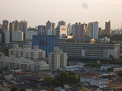
Santo André – miasto w południowo-wschodniej Brazylii, w stanie São Paulo, w regionie metropolitalnym São Paulo. Około 659,3 tys. mieszkańców.
Urodziła się tutaj Macris Carneiro, brazylijska siatkarka.
Miasta partnerskie
Media użyte na tej stronie
The flag of Navassa Island is simply the United States flag. It does not have a "local" flag or "unofficial" flag; it is an uninhabited island. The version with a profile view was based on Flags of the World and as a fictional design has no status warranting a place on any Wiki. It was made up by a random person with no connection to the island, it has never flown on the island, and it has never received any sort of recognition or validation by any authority. The person quoted on that page has no authority to bestow a flag, "unofficial" or otherwise, on the island.
Flag of Portugal, created by Columbano Bordalo Pinheiro (1857-1929), officially adopted by Portuguese government in June 30th 1911 (in use since about November 1910). Color shades matching the RGB values officially reccomended here. (PMS values should be used for direct ink or textile; CMYK for 4-color offset printing on paper; this is an image for screen display, RGB should be used.)
Autor: Gagomon, Licencja: CC BY-SA 3.0
A fabrica do moinho são jorge na cidade de santo andré
Autor: Raphael Lorenzeto de Abreu, Licencja: CC BY 2.5
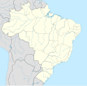
Location map of São Paulo state.
Equirectangular projection, N/S stretching 108 %. Geographic limits of the map:
- N: 19.67° S
- S: 25.45° S
- W: 53.20° W
- E: 44.01° W


