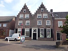
Scherpenzeel
| |||||
 | |||||
| Państwo | |||||
| Prowincja | Geldria | ||||
| Burmistrz | Ben Visser (2014)[1] | ||||
| Powierzchnia | 13,81 km² | ||||
| Populacja (2014) • liczba ludności | 9 496 [2] | ||||
| Nr kierunkowy | 033 | ||||
| Kod pocztowy | 3925 | ||||
| Strona internetowa | |||||
Scherpenzeel – gmina w prowincji Geldria w Holandii.
Przypisy
- ↑ scherpenzeel.nl: Samenstelling B&W (niderl.). [dostęp 2016-02-08].
- ↑ Aktualna liczba mieszkańców gminy (nl) [dostęp 12 lipca 2014]
Media użyte na tej stronie
Flag of Scherpenzeel.svg
Flag of the Dutch municipality of Scherpenzeel (Gelderland)
Flag of the Dutch municipality of Scherpenzeel (Gelderland)
Coat of arms of Scherpenzeel.svg
Coat of arms of Scherpenzeel (Netherlands).
Coat of arms of Scherpenzeel (Netherlands).
Netherlands Gelderland location map.svg
Autor: Erik Frohne, Licencja: CC BY-SA 3.0
Location map of province Gelderland in the Netherlands
Autor: Erik Frohne, Licencja: CC BY-SA 3.0
Location map of province Gelderland in the Netherlands
Equirectangular projection, N/S stretching 163 %. Geographic limits of the map:
- N: 52.522° N
- S: 51.731° N
- W: 4.989° E
- E: 6.834° E


