St. Leon-Rot

St. Leon-Rot
gmina
ilustracja
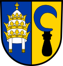
Herb
Herb
Państwo

 Niemcy

Kraj związkowy

 Badenia-Wirtembergia

Rejencja

Karlsruhe

Powiat

Rhein-Neckar-Kreis

Związek regionalny

Rhein-Neckar

Kod statystyczny

08 2 26 103

Powierzchnia

25,56 km²

Wysokość

107 m n.p.m.

Populacja (31 grudnia 2010)
• liczba ludności


12 839

• gęstość

502 os./km²

Numer kierunkowy

06227

Kod pocztowy

68789

Tablice rejestracyjne

HD

Adres urzędu:
Rathausstraße 2
68789 St. Leon-Rot
Położenie na mapie powiatu
Położenie na mapie
49°16′N 8°36′E/49,266667 8,600000
Strona internetowa
Portal Niemcy

St. Leon-Rot, Sankt Leon-Rot – gmina w Niemczech, w kraju związkowym Badenia-Wirtembergia, w rejencji Karlsruhe, w regionie Rhein-Neckar, w powiecie Rhein-Neckar-Kreis. Leży ok. 15 km na południe od Heidelbergu, przy autostradach A5 i A6.

Zobacz też

Media użyte na tej stronie

COA Rhein-Neckar-Kreis.svg
Coat of Arms of the Rhein-Neckar-Kreis, Germany.
St.-Leon-Rot-Rathaus.jpg
Autor: Frank, Licencja: CC BY-SA 2.5
Town hall in St. Leon-Rot
COA St Leon-Rot.svg
Wappen von St. Leon-Rot, Rhein-Neckar-Kreis, Deutschland.
St. Leon-Rot in HD.svg
Deutsch (de): Lagekarte von St. Leon-Rot, Rhein-Neckar-Kreis, Baden-Württemberg, Deutschland.
English (en): Locator map of St. Leon-Rot in Rhein-Neckar-District, Baden-Württemberg, Germany.
français (fr): Plan de localisation de la municipalité St. Leon-Rot dans l'arrondissement de Rhin-Neckar dans Bade-Wurtemberg, Allemagne.
hornjoserbsce (hsb): Poziciska karta gmejny St. Leon-Rot, Rhein-Neckar-Kreis, Baden-Württemberg, Němska.
македонски (mk): Положбена карта на St. Leon-Rot во рамките на Rhein-Neckar-Kreis, Baden-Württemberg, Германија.
Nederlands (nl): Detailkaart van St. Leon-Rot in de Rhein-Neckar-Kreis, Baden-Württemberg, Duitsland.
Esperanto (eo): Situomapo de St. Leon-Rot en distrikto Rhein-Neckar, Baden-Württemberg, Germanio.
മലയാളം (ml): ജർമ്മനിയിലെ Baden-Württemberg, Rhein-Neckar-District, St. Leon-Rot ഭൂപടസ്ഥാനം.