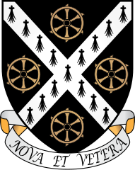
St Catherine’s College w Oksfordzie
| ||
 Herb Kolegium | ||
| Dewiza | Nova et Vetera (Nowe i Stare) | |
| Data założenia | 1962 | |
| Patron | Katarzyna Aleksandryjska | |
| Państwo | ||
| Kraj | ||
| Adres | OX1 3UJ Manor Road, Oksford | |
| Liczba studentów | 950 | |
| Dziekan | Roger Ainsworth | |
Położenie na mapie Oksfordu Contains Ordnance Survey data © Crown copyright and database right, CC BY-SA 3.0 | ||
Położenie na mapie Wielkiej Brytanii (c) Karte: NordNordWest, Lizenz: Creative Commons by-sa-3.0 de | ||
Położenie na mapie Oxfordshire Contains Ordnance Survey data © Crown copyright and database right, CC BY-SA 3.0 | ||
| Strona internetowa | ||
St Catherine's College (Kolegium św. Katarzyny) – jedno z najmłodszych z kolegiów wchodzących w skład University of Oxford, założone w 1962 roku z inicjatywy znanego historyka Alana Bullocka, który został jego pierwszym dziekanem.
Kolegium wywodzi swoje korzenie od działającego od 1868 klubu studentów, którzy ze względu na wysokie opłaty członkowskie studiowali w Oksfordzie bez przynależności do któregokolwiek z kolegiów, tworząc własne quasi-kolegium na potrzeby życia towarzyskiego, a potem także naukowego[1]. W 1974 Kolegium św. Katarzyny stało się pierwszym w Oksfordzie, które zaczęło przyjmować słuchaczy studiów licencjackich obu płci (wcześniej koedukacja obowiązywała wyłącznie w kolegiach przeznaczonych jedynie dla magistrantów i doktorantów, natomiast kolegia licencjackie były osobne dla kobiet i mężczyzn). Obecnie należy do niego ok. 950 studentów, w tym 500 na studiach licencjackich oraz 410 magistrantów i doktorantów (reszta to tzw. visiting students)[2].
Znani absolwenci
- Benazir Bhutto – pakistańska polityk
- David Hemery – mistrz olimpijski w lekkoatletyce
- Peter Mandelson – polityk
- Matthew Pinsent – mistrz olimpijski w wioślarstwie
- John Warcup Cornforth – chemik, laureat Nagrody Nobla
Przypisy
- ↑ College History (ang.). St Catherine's College. [dostęp 2012-06-08].
- ↑ student numbers (ang.). University of Oxford. [dostęp 2018-04-29].
| ||||
Media użyte na tej stronie
(c) Karte: NordNordWest, Lizenz: Creative Commons by-sa-3.0 de
Location map of the United Kingdom
Contains Ordnance Survey data © Crown copyright and database right, CC BY-SA 3.0
Map of Oxfordshire, UK with the following information shown:
- Administrative borders
- Coastline, lakes and rivers
- Roads and railways
- Urban areas
Equirectangular map projection on WGS 84 datum, with N/S stretched 160%
Geographic limits:
- West: 1.74W
- East: 0.72W
- North: 52.19N
- South: 51.44N
Flag of England. Saint George's cross (a red cross on a white background), used as the Flag of England, the Italian city of Genoa and various other places.
Autor: ChevronTango, Licencja: CC BY-SA 3.0
Vector graphic coat of arms of the Oxford college with motto
Coat of Arms of Oxford University
Contains Ordnance Survey data © Crown copyright and database right, CC BY-SA 3.0
Map of Oxford, Oxfordshire, UK with electoral wards shown.
Equirectangular map projection on WGS 84 datum, with N/S stretched 160%
Geographic limits:
- West: 1.32W
- East: 1.17W
- North: 51.81N
- South: 51.69N


