Stade Sébastien Charléty
| Ten artykuł od 2012-05 wymaga zweryfikowania podanych informacji. |
(c) Arne Müseler / www.arne-mueseler.com, CC BY-SA 3.0 de | |
| Państwo | |
|---|---|
| Region | |
| Miejscowość | |
| Data otwarcia | |
| Pojemność stadionu | 20 000 |
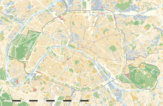
Położenie na mapie Paryża (c) Eric Gaba, Wikimedia Commons user Sting, CC BY-SA 3.0 | |
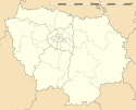
Położenie na mapie Île-de-France (c) Eric Gaba, Wikimedia Commons user Sting, CC BY-SA 3.0 | |
Stade Sébastien Charléty – stadion sportowy w Paryżu. Obecnie rozgrywane są tam głównie mecze rugby. Oficjalna pojemność stadionu wynosi 20 000 miejsc.
Stadion został zbudowany w 1938 roku, na bazie projektu francuskiego architekta, Bernarda Zehrfussa. Oprócz meczów rugby na stadionie rozgrywane są domowe mecze zespołu piłkarskiego Paris FC.
W maju 1968 roku na stadionie odbyło się wielkie spotkanie związku studentów francuskich, na którym zjawiło się od 30 000 do 50 000 osób. Było to jedno z najważniejszych wydarzeń podczas majowych protestów studenckich.
Media użyte na tej stronie
(c) Eric Gaba, Wikimedia Commons user Sting, CC BY-SA 3.0
Blank land cover map of the city and department of Paris, France, as in January 2012, for geo-location purpose, with distinct boundaries for departments and arrondissements.
Autor: Superbenjamin, Licencja: CC BY-SA 4.0
Blank administrative map of France for geo-location purpose, with regions and departements distinguished. Approximate scale : 1:3,000,000
(c) Eric Gaba, Wikimedia Commons user Sting, CC BY-SA 3.0
Blank administrative map of the region of Île-de-France, France, as in January 2015, for geo-location purpose, with distinct boundaries for regions, departments and arrondissements.
Autor:
- Gfi-set01-stadium.png: gfi
- derivative work: Frédéric (talk)
icone pour terrain de sport
Autor: Patricia.fidi, Licencja: CC0
Unofficial (de facto) flag of the region Île-de-France in France. It was also the flag of the kingdom of France (s.XIV-XV)
(c) Arne Müseler / www.arne-mueseler.com, CC BY-SA 3.0 de
Stade Charléty, Paris, France


