Stockbridge (Edynburg)
| Część miasta Edynburga | |
 St Stephens Street | |
| Państwo | |
|---|---|
| Kraj | |
| Miasto | |
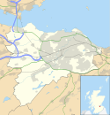
Położenie na mapie Edynburga Contains Ordnance Survey data © Crown copyright and database right, CC BY-SA 3.0 | |
Położenie na mapie Wielkiej Brytanii (c) Karte: NordNordWest, Lizenz: Creative Commons by-sa-3.0 de | |
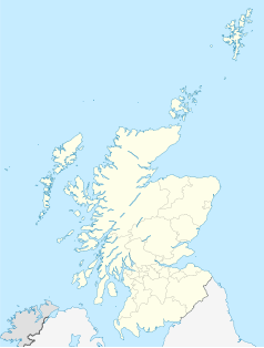
Położenie na mapie Szkocji | |
| 55,9588°N 3,2102°W/55,958800 -3,210160 | |
| Portal | |
Stockbridge – dzielnica Edynburga nazywana czasami New New Town, ciągnąca się od edynburskiego West End po Royal Botanic Gardens.
Media użyte na tej stronie
(c) Karte: NordNordWest, Lizenz: Creative Commons by-sa-3.0 de
Location map of the United Kingdom
(c) Eric Gaba, NordNordWest, CC BY-SA 3.0
Location map of Scotland, United Kingdom
Autor: Stephencdickson, Licencja: CC BY-SA 4.0
St Stephens Street (east), Edinburgh
Arms of the Scottish city of Edinburgh, from Plate V of Arthur Fox-Davies's A Complete Guide to Heraldry. This work was illustrated by Graham Johnston; herald-painter to the Lyon Court.
Contains Ordnance Survey data © Crown copyright and database right, CC BY-SA 3.0
Blank map of Edinburgh, UK with the following information shown:
- Administrative borders
- Coastline, lakes and rivers
- Roads and railways
- Urban areas
Equirectangular map projection on WGS 84 datum, with N/S stretched 175%
Geographic limits:
- West: 3.47W
- East: 3.05W
- North: 56.05N
- South: 55.80N


