Treigny-Perreuse-Sainte-Colombe
| gmina | |
 Zamek Ratilly w gminie Treigny-Perreuse-Sainte-Colombe | |
| Państwo | |
|---|---|
| Region | |
| Departament | |
| Okręg | |
| Kod INSEE | 89420 |
| Powierzchnia | 67,46 km² |
| Populacja (2016[a]) • liczba ludności |
|
| Kod pocztowy | 89520 |
| Portal | |
Treigny-Perreuse-Sainte-Colombe – gmina we Francji, w regionie Burgundia-Franche-Comté, w departamencie Yonne. W 2016 roku populacja ludności wynosiła 1033 mieszkańców[1].
Gmina została utworzona 1 stycznia 2019 roku z połączenia dwóch ówczesnych gmin: Sainte-Colombe-sur-Loing oraz Treigny. Siedzibą gminy została miejscowość Treigny[2].
Uwagi
- ↑ Gmina istnieje od 2019 roku, jednak dane liczby ludności pochodzą z 2016 roku i obejmują zsumowaną liczbę ludności gmin, z których powstała.
Przypisy
- ↑ Populations légales 2016. INSEE. [dostęp 2020-04-29]. (fr.).
- ↑ Recueil des Actes Administratif de l'Yonne. yonne.gouv.fr. [dostęp 2020-04-29]. (fr.).
Media użyte na tej stronie
Autor: Flappiefh, Licencja: CC BY-SA 4.0
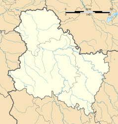
Blank administrative map of the department of Yonne, France, for geo-location purpose.
Autor: Superbenjamin, Licencja: CC BY-SA 4.0
Blank administrative map of France for geo-location purpose, with regions and departements distinguished. Approximate scale : 1:3,000,000
Autor: Flappiefh, Licencja: CC BY-SA 4.0
Carte administrative vierge de la région Bourgogne-Franche-Comté, France, destinée à la géolocalisation.
Autor: Lexe-I, Licencja: CC BY 2.0
The Castle of Ratilly, located in the village of Treigny, has kept its 12th century feudal appearance. Few modifications were made until the 17th century. During the Religious Wars, the castle was used as a shelter for Huguenots and at the beginning of the 18th century, Jansenists found refuge in Ratilly. In 1951 Jeanne and Norbert Pierlot made a stoneware pottery workshop in the castle. The Castle of Ratilly became a place where artistic exchanges, research and expression took place. Today their work is continued by the current generation, their five children Martin, Nathalie, Luc, Jean et Claire Pierlot.
In summer, exhibitions of modern art, concerts and music courses within the context of the Festival ‘Musique à Ratilly’ take place in the castle. Permanent exhibition of local stoneware (16th-20th century).
Open: in summer daily 10 a.m to 6 p.m. In spring and autumn, during the week, 10 a.m. to 12 a.m. and from 2 p.m. to 5 p.m. and during weekends from 3 p.m. to 6 p.m. In winter, during the week, 10 a.m. to 12 a.m. and from 2 p.m. to 5 p.m. Closed on Sundays.


