Trinity River (Teksas)
 Trinity River w Fort Worth | |
| Kontynent | |
|---|---|
| Państwo | |
| Lokalizacja | |
| Rzeka | |
| Długość | 1140 km |
| Powierzchnia zlewni | 40 380 km² |
| Źródło | |
| Miejsce | Hrabstwo Montague |
| Wysokość | 121 m n.p.m.[1] |
| Współrzędne | |
| Ujście | |
| Recypient | |
| Miejsce | Trinity Bay[2] |
| Wysokość | 0 m n.p.m. |
| Współrzędne | |
| Mapa | |
 | |
Trinity River – rzeka w Stanach Zjednoczonych, w Teksasie.
Rzeka bierze swój początek z połączenia 4 odnóg West Fork, Clear Fork, Elm Fork oraz East Fork[3]. Dwa pierwsze łączą się niedaleko Fort Worth, do nich około 40 km dalej, w pobliżu Dallas wpływa Elm Fork i po kolejnych 50 km połączyć się z ostatnim East Fork[2]. Rzeka oraz tworzące ją dopływy mają charakter rzeki nizinnej, obficie meandrującej[3]
Na rzece Trinity jest kilka zapór tworzących sztuczne jeziora. Największymi z nich są Ray Roberts Lake, Lake Conroe, Lavon Lake, Benbrook Lake i Lake Livingston[2]. Wszystkie te zbiorniki oprócz charakteru regulacyjnego i zapewnienia wody w okresach suszy mają także charakter rekreacyjny. Lake Livingston zajmuje powierzchnię ponad 336 km², oraz ma 50 km długości[2].
Rzeka poprzez Zatokę Trinity (ang. Trinity Bay) uchodzi do Zatoki Galveston skąd dalej do Zatoki Meksykańskiej[4]
Zobacz też
Przypisy
- ↑ Feature Detail Report for: West Fork Trinity River
- ↑ a b c d Major Waterways of East Texas, Trinity River (ang.). Texas Parks and Wildlife Department. [dostęp 2014-04-04].
- ↑ a b Wayne Gard: Trinity River (ang.). W: The Handbook of Texas Online [on-line]. The General Libraries at the University of Texas at Austin and the Texas State Historical Association, 1999-02-15. [dostęp 2014-03-07].
- ↑ Verne Huser: Rivers of Texas (ang.). [dostęp 2014-04-07].
Media użyte na tej stronie
The flag of Navassa Island is simply the United States flag. It does not have a "local" flag or "unofficial" flag; it is an uninhabited island. The version with a profile view was based on Flags of the World and as a fictional design has no status warranting a place on any Wiki. It was made up by a random person with no connection to the island, it has never flown on the island, and it has never received any sort of recognition or validation by any authority. The person quoted on that page has no authority to bestow a flag, "unofficial" or otherwise, on the island.
Autor: i_am_jim, Licencja: CC BY-SA 3.0
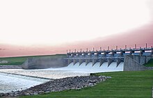
Downstream side of Lake Livingston Dam in Polk County Texas
Autor: w:flickr user kinez, Licencja: CC BY-SA 2.0
The w:Trinity River (Texas) north of downtown Fort Worth, Texas
Autor: Uwe Dedering, Licencja: CC BY-SA 3.0
Relief location map of the USA (without Hawaii and Alaska).
EquiDistantConicProjection : Central parallel :
* N: 37.0° N
Central meridian :
* E: 96.0° W
Standard parallels:
* 1: 32.0° N
* 2: 42.0° N
Made with Natural Earth. Free vector and raster map data @ naturalearthdata.com.
Formulas for x and y:
x = 50.0 + 124.03149777329222 * ((1.9694462586094064-({{{2}}}* pi / 180))
      * sin(0.6010514667026994 * ({{{3}}} + 96) * pi / 180))
y = 50.0 + 1.6155950752393982 * 124.03149777329222 * 0.02613325650382181
      - 1.6155950752393982  * 124.03149777329222 *
     (1.3236744353715044  - (1.9694462586094064-({{{2}}}* pi / 180))
      * cos(0.6010514667026994 * ({{{3}}} + 96) * pi / 180))
Autor: Autor nie został podany w rozpoznawalny automatycznie sposób. Założono, że to Kuru (w oparciu o szablon praw autorskich)., Licencja: CC BY-SA 2.5
This is a map of the Trinity River watershed in Texas. I, Kuru, created from data originating at the USGS.


