Truckee
| Ten artykuł od 2014-04 wymaga zweryfikowania podanych informacji. |
(c) Bruce C. Cooper (DigitalImageServices.com), CC BY 2.5 Truckee w Kalifornii | |
| Kontynent | |
|---|---|
| Państwo | |
| Lokalizacja | |
| Rzeka | |
| Długość | 225 km |
| Źródło | |
| Miejsce | Sierra Nevada |
| Współrzędne | |
| Ujście | |
| Recypient | |
| Miejsce | Pyramid |
| Współrzędne | |
Truckee (ang. Truckee River) – rzeka w północnej Kalifornii i północnej Nevadzie (USA) o długości 225 km (140 mil). Swój bieg rozpoczyna w górach Sierra Nevada, a kończy w jeziorze Pyramid (Great Basin).
Jej zasoby są ważnym źródłem nawadniania w dolinach wzdłuż jej biegu. W okolicach jeziora Tahoe jej wody są czyste i przejrzyste, ale w dalszym biegu w okolicach Reno stają się bardziej muliste.
Media użyte na tej stronie
The flag of Navassa Island is simply the United States flag. It does not have a "local" flag or "unofficial" flag; it is an uninhabited island. The version with a profile view was based on Flags of the World and as a fictional design has no status warranting a place on any Wiki. It was made up by a random person with no connection to the island, it has never flown on the island, and it has never received any sort of recognition or validation by any authority. The person quoted on that page has no authority to bestow a flag, "unofficial" or otherwise, on the island.
(c) Bruce C. Cooper (DigitalImageServices.com), CC BY 2.5
View of the Truckee River from the UPRR grade just East of Truckee, CA.
Autor: Kmusser, Licencja: CC BY-SA 3.0
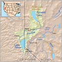
Map showing the Truckee River drainage basin — in California and Nevada.
Autor: Uwe Dedering, Licencja: CC BY-SA 3.0
Relief location map of the USA (without Hawaii and Alaska).
EquiDistantConicProjection : Central parallel :
* N: 37.0° N
Central meridian :
* E: 96.0° W
Standard parallels:
* 1: 32.0° N
* 2: 42.0° N
Made with Natural Earth. Free vector and raster map data @ naturalearthdata.com.
Formulas for x and y:
x = 50.0 + 124.03149777329222 * ((1.9694462586094064-({{{2}}}* pi / 180))
      * sin(0.6010514667026994 * ({{{3}}} + 96) * pi / 180))
y = 50.0 + 1.6155950752393982 * 124.03149777329222 * 0.02613325650382181
      - 1.6155950752393982  * 124.03149777329222 *
     (1.3236744353715044  - (1.9694462586094064-({{{2}}}* pi / 180))
      * cos(0.6010514667026994 * ({{{3}}} + 96) * pi / 180))


