White River (dopływ Missouri)
| Ten artykuł od 2014-04 wymaga zweryfikowania podanych informacji. |
| ||
 | ||
| Kontynent | Ameryka Północna | |
| Państwo | ||
| Lokalizacja | Nebraska, Dakota Południowa | |
| Rzeka | ||
| Długość | 816 km | |
| Powierzchnia zlewni | 26 400 km² | |
| Źródło | ||
| Miejsce | Pine Ridge | |
| Wysokość | 1 463 n.p.m. | |
| Współrzędne | 42°41′10,0″N 103°50′13,9″W/42,686100 -103,837200 | |
| Ujście | ||
| Recypient | Missouri | |
| Współrzędne | 43°42′50,0″N 99°28′01,2″W/43,713900 -99,467000 | |
| Mapa | ||
 Bieg i dopływy White River | ||
White River – jeden z dopływów Missouri liczący 816 km długości. Przepływa przez amerykańskie stany Nebraska oraz Dakota Południowa. Jej nazwa pochodzi od mlecznego koloru wód. Indianie Wielkich Prerii nazywali ją "Rzeką Zadymionej Ziemi"
Media użyte na tej stronie
The flag of Navassa Island is simply the United States flag. It does not have a "local" flag or "unofficial" flag; it is an uninhabited island. The version with a profile view was based on Flags of the World and as a fictional design has no status warranting a place on any Wiki. It was made up by a random person with no connection to the island, it has never flown on the island, and it has never received any sort of recognition or validation by any authority. The person quoted on that page has no authority to bestow a flag, "unofficial" or otherwise, on the island.
Autor: Jon Platek, Licencja: CC BY-SA 3.0
Map of the course, watershed, and tributaries of the White River in the US states of Nebraska and South Dakota.
Autor: Thomas & Dianne Jones from Okmulgee, OK, USA, Licencja: CC BY 2.0
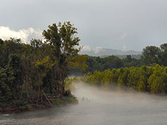
Even in the hottest part of day in late July, cool mists slip across The White River.
Autor: Uwe Dedering, Licencja: CC BY-SA 3.0
Relief location map of the USA (without Hawaii and Alaska).
EquiDistantConicProjection : Central parallel :
* N: 37.0° N
Central meridian :
* E: 96.0° W
Standard parallels:
* 1: 32.0° N
* 2: 42.0° N
Made with Natural Earth. Free vector and raster map data @ naturalearthdata.com.
Formulas for x and y:
x = 50.0 + 124.03149777329222 * ((1.9694462586094064-({{{2}}}* pi / 180))
      * sin(0.6010514667026994 * ({{{3}}} + 96) * pi / 180))
y = 50.0 + 1.6155950752393982 * 124.03149777329222 * 0.02613325650382181
      - 1.6155950752393982  * 124.03149777329222 *
     (1.3236744353715044  - (1.9694462586094064-({{{2}}}* pi / 180))
      * cos(0.6010514667026994 * ({{{3}}} + 96) * pi / 180))


