Whittlesey
| ||
(c) Michael Trolove, CC BY-SA 2.0 | ||
| Państwo | ||
| Kraj | ||
| Hrabstwo | Cambridgeshire | |
| Dystrykt | Fenland | |
| Populacja (2001) • liczba ludności | 15 581 (2001 Census)[1] | |
| Nr kierunkowy | 01733 | |
| Kod pocztowy | PE7 | |
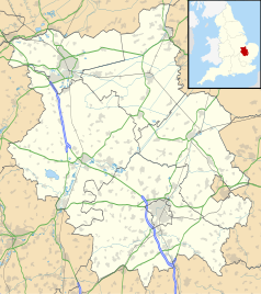
Położenie na mapie Cambridgeshire Contains Ordnance Survey data © Crown copyright and database right, CC BY-SA 3.0 | ||
Położenie na mapie Wielkiej Brytanii (c) Karte: NordNordWest, Lizenz: Creative Commons by-sa-3.0 de | ||
| Portal | ||
Whittlesey – miasto w Anglii, w hrabstwie Cambridgeshire, w dystrykcie Fenland. Leży 43 km na północny zachód od miasta Cambridge i 117 km na północ od Londynu[2]. W 2001 miasto liczyło 15 581 mieszkańców[1].
Przypisy
- ↑ a b Zarchiwizowana kopia. [dostęp 2010-10-06]. [zarchiwizowane z tego adresu (2006-01-13)].
- ↑ Whittlesey na mapie (ang.). getamap.ordnancesurvey.co.uk. [dostęp 2010-10-06].
Media użyte na tej stronie
(c) Karte: NordNordWest, Lizenz: Creative Commons by-sa-3.0 de
Location map of the United Kingdom
Flag of England. Saint George's cross (a red cross on a white background), used as the Flag of England, the Italian city of Genoa and various other places.
(c) Michael Trolove, CC BY-SA 2.0
Butter Cross, Whittlesey, near to Whittlesey, Cambridgeshire, Great Britain. A late 17th Century building used as an open market, threatened with demolition in its early life, now an attractive town centre feature. For a long time in the 20th century buses and cars vied for space around the structure. In 1999 Fenland District Council enhanced the area making it more pedestrian friendly.
Contains Ordnance Survey data © Crown copyright and database right, CC BY-SA 3.0
Map of Cambridgeshire, UK with the following information shown:
- Administrative borders
- Coastline, lakes and rivers
- Roads and railways
- Urban areas
Equirectangular map projection on WGS 84 datum, with N/S stretched 160%
Geographic limits:
- West: 0.53W
- East: 0.55E
- North: 52.75N
- South: 51.99N


