Wyspy Morza Śródziemnego

Wyspy Morza Śródziemnego, leżącego pomiędzy Europą, Afryką i Azją.

Według powierzchni

 WyspaZdjęciePaństwoPowierzchnia
(km²)
Maks. wysokość
(m n.p.m.)
1SycyliaSatellite image Sicily.jpg Włochy25 4603 322
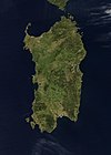
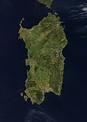
2SardyniaSardinia satellite.jpg Włochy23 8131 834
3CyprSatellite image of Cyprus, cropped.jpg Cypr[a]9 2511 951
4KorsykaCorse-photosat.jpg Francja8 6812 710
5KretaCrete Nasa.jpg Grecja8 3362 456
6EubeaEuboea island.jpg Grecja3 6551 743
7MajorkaMallorca.jpg Hiszpania3 6401 445
8LesbosLesbos small.jpg Grecja1 630968
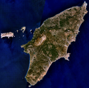
9RodosRhodes NLT Landsat7.png Grecja1 3981 215
10ChiosChios NASA satellite image.jpg Grecja8421 297
11KefaliniaKephalonia.png Grecja7811 628
12MinorkaMenorca.jpg Hiszpania692357
13KorfuCorfouSatellite.jpg Grecja592906
14IbizaIbiza.jpg Hiszpania577475
15DżerbaISD highres ISS002 ISS002-749-82 3.JPG Tunezja52349
16LimnosLimnos from space.jpg Grecja476319
17SamosSamos 26.80174E 37.72709N.jpg Grecja4761 433
18Naksos Grecja4281 001
19ZakintosZakynthosWW.jpg Grecja406756
20Cres Chorwacja406639
21KrkKrk (island).jpg Chorwacja406568
22Brač Chorwacja395778
23Andros Grecja380944
24ThasosThasos.jpg Grecja3781 127
25Leukada Grecja3031 158
26Karpatos Grecja3011 215
27HvarHvar Satellite.jpg Chorwacja300626
28Kos Grecja290875
29PagPag Satellite.jpg Chorwacja285348
30Imroz Turcja279610
31Kithira Grecja278507
32KorčulaKorcula Satellite.jpg Chorwacja276568
33Ikaria Grecja2551 042
34MaltaMalta ali 2009224 lrg.jpg Malta246253
35ElbaAerial view of Elba 1.jpg Włochy2241 018
36Skiros Grecja209792
37Paros Grecja195724
38Tinos Grecja194726
39Samotraka Grecja1781 611
40Milos Grecja151748
41Kiea Grecja129560
42Amorgos Grecja121823
43MarmaraMarmara Island aerial view.jpg Turcja117
44Dugi Otok Chorwacja114300
45Kalimnos Grecja111760
46Szarki Tunezja110
47Sant’Antioco Włochy10920
48Ios Grecja108732
49Mljet Chorwacja100514
50Kitnos Grecja100356
51Astipalea Grecja97482
52Itaka Grecja96809
53Skopelos Grecja96567
54SalaminaSalamis.png Grecja95365
55Rab Chorwacja91408
56VisVis Bisevo satelite.gif Chorwacja90348
57Mykonos Grecja86341
58Siros Grecja84442
59Egina Grecja83531
60FormenteraFormentera sat.png Hiszpania83119
61Pantelleria
Ortofoto-piccola.jpg
(c) User: Mediterranean.web z wikipodróże shared, CC BY-SA 3.0
 Włochy83836
62SantorynISS-48 Santorini Caldera, Greece.jpg Grecja76567
63Lošinj Chorwacja75588
64Serifos Grecja73585
65Sifnos Grecja73682
66GharbiKerkennah Islands NASA.jpg Tunezja69
67GozoGozo from space via laser ESA378503 (cropped).jpg Malta67195
68Kasos Grecja66550
69Alonisos Grecja64456
70Tilos Grecja63612
71Pašman Chorwacja63892
72ŠoltaSolta satelite.jpg Chorwacja59238
73Simi Grecja58617
74Leros Grecja53327
75San Pietro Włochy51211
76Asinara Włochy51408
77Hydra Grecja50592
78Ugljan Chorwacja50288
79Skiatos Grecja48433
80Lastovo Chorwacja47417
81Ischia Włochy46789
82Ajos Efstratios Grecja43298
83NisirosNisyros.jpg Grecja41588
84Sikinos Grecja41552
85Psara Grecja40512
86Anafi Grecja38584
87Lipari Włochy37602
88Bozca Turcja36192
89Kimolos Grecja36397
90Andiparos Grecja35308
91Patmos Grecja35269
92Kornat Chorwacja32207
93Folegandros Grecja32416
94Furni Grecja30514
95Gawdos Grecja30368
96Čiovo Chorwacja29220
97Chalki Grecja28593
98Salina Włochy27962
99Olib Chorwacja2674
100UzunadaIzmir turkey.jpg Turcja25
101Paksos Grecja25248
102Kalamos Grecja25747
103Kyra Panagia Grecja25302
104Isola del GiglioAerial view of Isola del Giglio, 2006-06-04.jpg Włochy24405
105Cunda Turcja23
106Poros Grecja23358
107Molat Chorwacja23142
108Vir Chorwacja22125
109Spetses Grecja22248
110Paşalimanı Turcja21
111SariaSaria Island Greece.jpg Grecja21631
112Vulcano Włochy21501
113Avşa Turcja21
114Lampedusa Włochy21113
115MaddalenaLa Maddalena Archipel Aerial view.jpg Włochy21
116Meganisi Grecja20297
117Favignana Włochy196
118Capraia Isola Włochy1952
119Murter Chorwacja19125
120MakronisosMakronissos.jpg Grecja18280
121Andikitira Grecja18378
122Elafonisos Grecja18275
123Iraklia Grecja18133
124Iz satelite.jpg Chorwacja18168
125Giaros Grecja17490
126Megalonisos Petalion Grecja17
127Poliegos Grecja17370
128Unije Chorwacja17132
129Lipsi Grecja16277
130Šipan Chorwacja16243
131Caprera Włochy16212
132CabreraArchipiélago de Cabrera.jpg Hiszpania16172
133Keros Grecja15432
134ŽirjeZirje satelite.gif Chorwacja15131
135Sestrunj Chorwacja15186
136SilbaSilba OnEarth WMS.png Chorwacja1580
137Žut Chorwacja15155
138Pserimos Grecja15268
139Inuses Grecja14182
140Peristera Grecja14250
141Rinia Grecja14136
142Agatonisi Grecja14209
143Donoussa Grecja14363
144Prvić Chorwacja14357
145Stromboli Włochy13926
146Dokos Grecja13308
147Île de Porquerolles Francja13142
148Schiza Grecja122
149Drvenik velikiDrvenik veliki satelite.png Chorwacja12177
150Marettimo Włochy12686
151Angistri Grecja12294
152DiaDia Island.jpg Grecja120
153Gioura Grecja110
154Capri Włochy10596
155MontecristoMontecristo island.corr.jpg Włochy102
156PianosaIle Pianosa, Italie, vue aérienne.jpg Włochy1010
157OthonoiGreece - View of Othoni island from an aircraft (sept 2018).jpg Grecja10631
158Thymaina Grecja10151
159İmralıİmralı.jpg Turcja10
160Ist Chorwacja9
161Filicudi Włochy9
162Therasia Grecja9
163Mejisti Grecja9
164Leuitha Grecja9
165Sapientza Grecja9
166Île du Levant Francja9
167Premuda Chorwacja8
168Ustica Włochy8
169Plavnik Chorwacja8
170Maun Chorwacja8
171Šćedro Chorwacja8
172Zlarin Chorwacja8
173Schoinousa Grecja8
174Andimilos Grecja8
175Syrna Grecja7
176Despotiko Grecja7
177Amuliani Grecja7
178Ponza Włochy7
179Alimia Grecja7
180Kaprije Grecja7
181Île de Port-Cros Francja7
182Arki Grecja6
183Sveti Grgor Chorwacja6
184Skantzoura Grecja6
185Biševo Chorwacja5
186Kastos Grecja5
187Tavolara Włochy5
188Levanzo Włochy5
189Koufonisia Grecja5
190Sazan Albania5
191Veliki Brijun Chorwacja5
192Ivonik Chorwacja5
193Antipaksi Grecja5
194Chrisi Grecja5
195Linosa Włochy5
196Sveti Klement Chorwacja5
197Alicudi Włochy5
198Nimos Grecja4
199Telendos Grecja4
200Dolin Chorwacja4
201Jali Grecja4
202Kinaros Grecja4
203Goli Otok Chorwacja4
204Lopud Chorwacja4
205Sveti Andrija Chorwacja4
206Zverinac Chorwacja4
207Sušac Chorwacja4

Uwagi

Media użyte na tej stronie

Flag of Croatia.svg
Łatwo można dodać ramkę naokoło tej grafiki
Flag of Albania.svg
Flag of Albania
Ile Pianosa, Italie, vue aérienne.jpg
Autor: Olivier Brunet, Licencja: CC BY-SA 3.0
Vue aérienne de l'ile de Pianosa, dans l'archipel Toscan en Italie
Sardinia satellite.jpg

Credit Jeff Schmaltz, MODIS Rapid Response Team, NASA/GSFC The island of Sardinia sits between the Mediterranean Sea to the south and west and the Tyrrhenian Sea to the east. To its immediate north is the island of Corsica, which is a part of France. To the east of Sardinia is the middle of the Italian peninsula (not shown). Sardinia glows here with the green blush of spring.

Sardinia has had a tumultuous history. Starting in ancient times, the island was occupied by Phoenicians, Carthaginians, and Romans; thereafter it was controlled by Vandals, Byzantines, and a long string of rulers of Italian city-states. In the late 15th century, Sardinia came under the control of Spain, then in the early 18th century was passed to the Austrians. It briefly fell to Spanish occupation in 1717, but by 1720 was given over again to the control of Italian rule. This true-color Aqua MODIS image was acquired on April 27, 2003.
Korcula Satellite.jpg
Satellite image of Italy in March 2003.
Zirje satelite.gif
Satelite image of Zirje island, Croatia.
Pag Satellite.jpg
Satellite image of Italy in March 2003.
Euboea island.jpg
Satellite image of the island of Euboea (Greece)
Gozo from space via laser ESA378503 (cropped).jpg
Autor: European Space Agency, Licencja: CC BY-SA 3.0 igo
This image of Malta, captured by the Copernicus Sentinel-2B satellite is one of the first set of images delivered via Alphasat, which is in geostationary orbit 36 000 km above Earth. The image is a result of the two satellites using their optical communication instruments to transfer data via laser for fast delivery. This is essential for applications such as helping respond to disasters.
Satellite image Sicily.jpg

Satellite image of Sicily

This true-color scene of a smoke plume streaming eastward from snow-capped Mount Etna was acquired on April 7, 2002, by the Moderate-resolution Imaging Spectroradiometer (MODIS), aboard NASA's Terra satellite. Mount Etna, towering above Catania, Sicily's second largest city, has one of the world's longest documented records of historical volcanism, dating back to 1500 BC. Historical lava flows cover much of the surface of this massive basaltic stratovolcano, the highest and most voluminous in Italy.
Dia Island.jpg
Autor:

Oryginalnym przesyłającym był Frente z niemieckiej Wikipedii

(Tekst oryginalny: „Frente), Licencja: CC BY-SA 2.0 de
Luftbild der Insel Dia
Izmir turkey.jpg
Izmir, Turkey - June 1996
Mallorca.jpg
Sattelite image of Majorca
CorfouSatellite.jpg
Autor: Oryginalnym przesyłającym był Siren z francuskiej Wikipedii, Licencja: CC-BY-SA-3.0
Vue satellite de l'île de Corfou
  • Source : Wikipédia anglais[1]
  • Siren 14 avr 2005 à 09:49 (CEST)
Chios NASA satellite image.jpg
Chios, or Khios, Island, Greece Located in the eastern Aegean Sea just off the coast of western Turkey, the Greek island of Chios can be seen in this near-nadir view. Chios Island is 30 miles (48 km) long and 8 to 15 miles (13 to 24 km) wide and covers an area of 350 sq. miles (905 sq. km). The island is hilly, scenic, and fertile with a good climate. Chios produces olives, figs, and mastic and has marble quarries, lignite deposits, and sulfur springs. Chios is noted in antiquity for its claims as Homer's birthplace and for its school of epic poets, the Homeridae. The land visible at the right center and top right is part of the country of Turkey.
Rhodes NLT Landsat7.png
Visible colour satellite image of Rhodes.
Marmara Island aerial view.jpg
Autor: Toksave, Licencja: CC BY-SA 3.0
Marmara Island, Turkey (Marmara Sea)
Lesbos small.jpg
Lesbos Island, Greece - September/October 1995
Limnos from space.jpg
Greek Island Moni from space
İmralı.jpg
İmrali island in Turkey as seen from satellite
Malta ali 2009224 lrg.jpg
L'île de Malte vue de l'espace.
Saria Island Greece.jpg
Autor: Oyoyoy, Licencja: CC BY-SA 3.0
Saria Island (Greek: Σαρία) is an island in Greece, along the northern edge of Karpathos, separated from it by a strait 100 m (330 ft) wide. Photo taken in flight.
Aerial view of Elba 1.jpg
Autor: Mjobling, Licencja: CC BY 3.0
Aerial view of the island of Elba
Hvar Satellite.jpg
Satellite image of Italy in March 2003.
Greece - View of Othoni island from an aircraft (sept 2018).jpg
Autor: Sebleouf, Licencja: CC BY-SA 4.0
Vue de l'île d'Othoni lors du survol de la mer Adriatique par un avion de ligne Aegean Airlines.
Aerial view of Isola del Giglio, 2006-06-04.jpg
Autor: Sky Eckstrom, Licencja: CC BY-SA 2.0
Aerial view of Isola del Giglio, looking from the North East
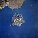
Thasos.jpg
Thasos Island, Greece
  • Thasos (Thassos) Island, famous in antiguity for its gold and marble lies 4 miles (6 km) off the coast of Greece in the northern Aegean Sea. Covering an area of 170 sq. miles (440 sq. km), the rugged, forested, mountainous island is composed of marble and gray green gneiss. Numerous sandy beaches dot the island. Ample rainfall in autumn and winter sustains the dense vegetation, which covers the landscape and makes the island a popular vacation resort area. Thasos Island is now famous for its honey as beehives are in evidence throughout the island. The long airport runway at Kavala Khrisoupolis Airport on mainland Greece is visible near the bottom center of the image.
Ortofoto-piccola.jpg
(c) User: Mediterranean.web z wikipodróże shared, CC BY-SA 3.0
Luftbild Insel Pantelleria
Makronissos.jpg
Autor: User:FocalPoint, Licencja: CC-BY-SA-3.0
Grecka wyspa Makronisos, przedstawiona tak, jak widywana jest również podczas lotów rejsowych z Polski. Zdjęcie wykonano w momencie zwrotu samolotu, czyli niezwłocznie po minięciu przylądka Sounio. Po lewej stronie fotografii widoczny jest brzeg Attyki, na nim m.in. zewnętrzne fragmenty portu dalekomorskiego w Lawrio. U góry fotografii, czyli już z tyłu za samolotem, oddala się wyspa Evia (Eubea).
ISS-48 Santorini Caldera, Greece.jpg
This photo of the Santorini Caldera in southeastern Greece was taken from the International Space Station.
Montecristo island.corr.jpg
Autor: Smiley.toerist, Licencja: CC BY-SA 3.0
Montecristo island seen from a flight from Schiphol to Antananarivo (Madagascar) Picture is cropped and corrected.)