Africa ethnic groups 1996
Autor:
United States. Central Intelligence Agency.
Credit:
Ten map pochodzący z zasobów Biblioteki Kongresu Stanów Zjednoczonych, oddziału Geography & Map Division jest dostępny pod numerem g8201e.ct001294.
Ten szablon nie wskazuje stanu prawnego pliku. Standardowy szablon licencji jest nadal wymagany. Aby dowiedzieć się więcej zajrzyj na stronę Commons:Licencja.
Ten szablon nie wskazuje stanu prawnego pliku. Standardowy szablon licencji jest nadal wymagany. Aby dowiedzieć się więcej zajrzyj na stronę Commons:Licencja.
Krótki link:
źródło:
Wymiary:
2446 x 2819 Pixel (5222353 Bytes)
Opis:
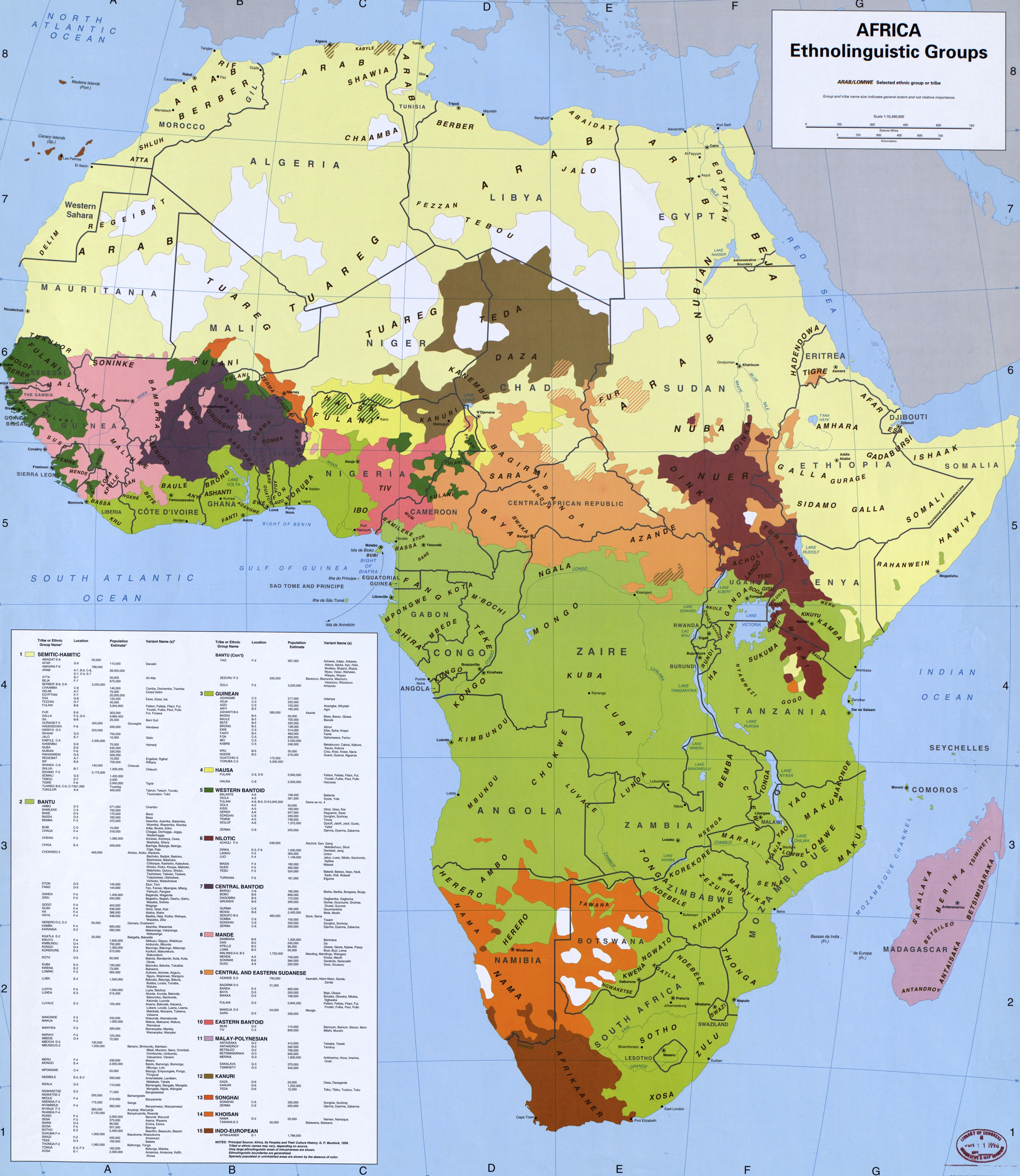
Ethnolinguistic groups of Africa, 1996 publication by the Library of Congress Geography and Map Division.
From the map legend:
- NOTE: Principal source: Africa, its peoples and their cultural history, G.P. Murdock, 1959.
- Tribal or ethnic names may vary, depending on source
- Only large ethnolinguistic areas of intrusiveness are shown
- Ethnolinguistic boundaries are generalized
- Sparsely populated or uninhabited areas are shown by the absence of color.
"Guinean" (Volta-Niger, Kru)
"Eastern Bantoid" (Southern Bantoid)
Nilo-Saharan (unity doubtful)
other
Licencja:
Public domain
Więcej informacji o licencji można znaleźć tutaj. Ostatnia aktualizacja: Sun, 30 Oct 2022 08:28:10 GMT