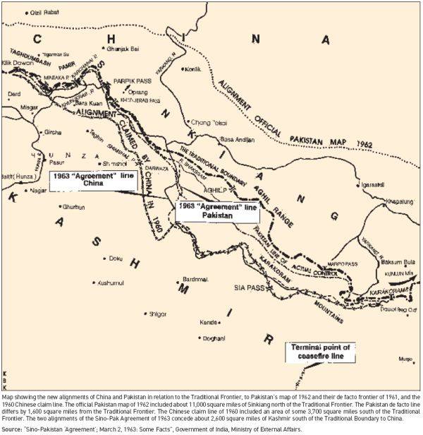
Alignment Official Pakistan map 1962
Autor:
The Government of India, Ministry of External Affairs
Credit:
Sino Pakistan "Agreement", March 2, 1963 "Some facts" published by the Government of India, Ministry of External Affairs
Krótki link:
źródło:
Wymiary:
600 x 616 Pixel (60033 Bytes)
Opis:
Map depicting the official alignment of the northern border of Kashmir in 1962 according to the Government of Pakistan
Licencja:
Public domain
Więcej informacji o licencji można znaleźć tutaj. Ostatnia aktualizacja: Tue, 13 Sep 2022 16:01:54 GMT