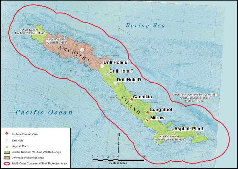
Amchitka Island Map
Autor:
Federal Government of the United States
Credit:
Krótki link:
źródło:
Wymiary:
794 x 564 Pixel (115750 Bytes)
Opis:
Map of Amchitka Island.
Licencja:
Public domain
Komentarz do licencji:
| This image is a work of a United States Department of Energy (or predecessor organization) employee, taken or made as part of that person's official duties. As a work of the U.S. federal government, the image is in the public domain.
Please note that national laboratories operate under varying licences and some are not free. Check the site policies of any national lab before crediting it with this tag.
|
 |
Więcej informacji o licencji można znaleźć tutaj. Ostatnia aktualizacja: Sun, 13 Nov 2022 07:34:07 GMT