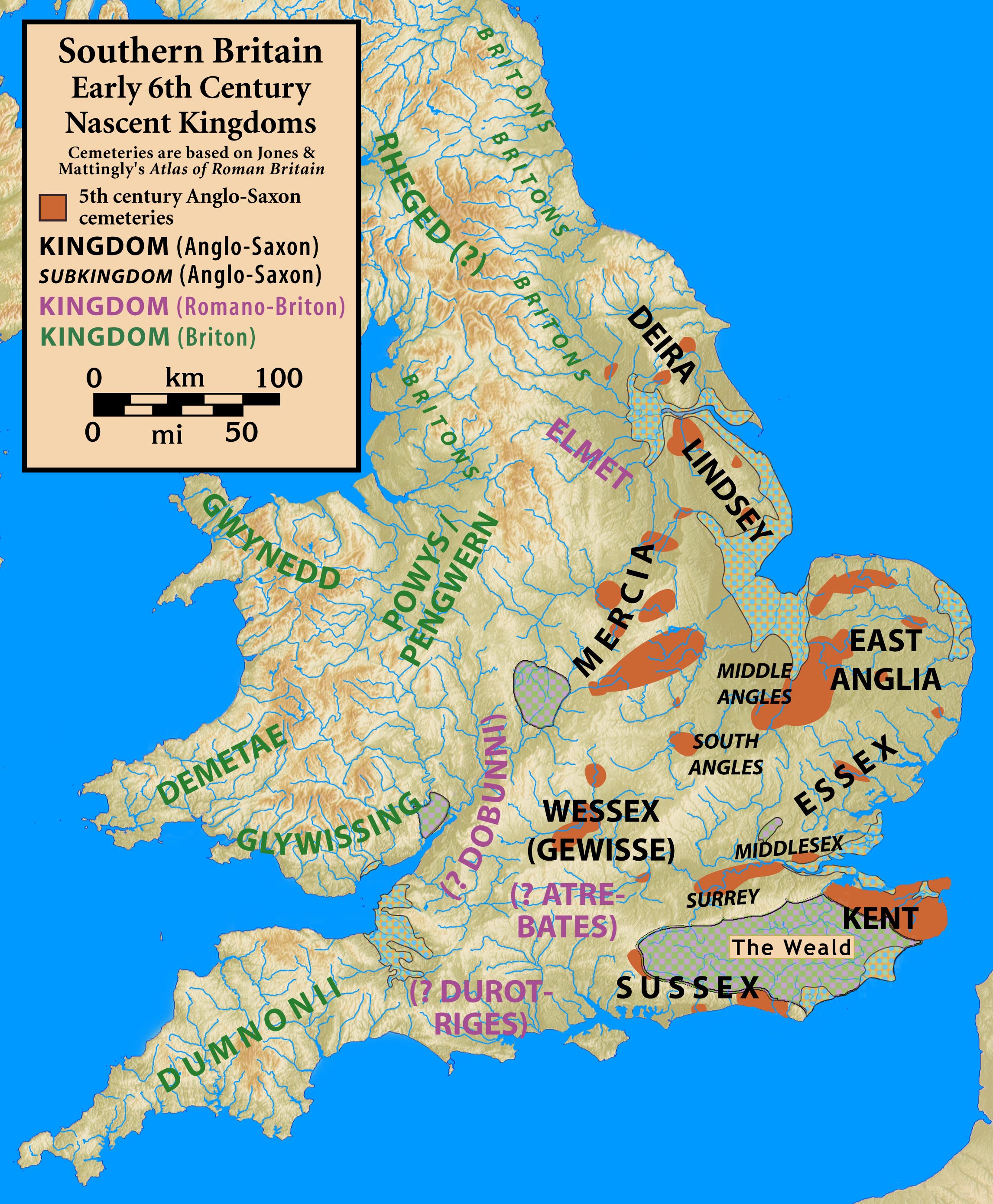
Britain.early.6th.century.nascent.kingdoms
Autor:
my work
Attribution:
Obraz jest oznaczony jako „Wymagane uznanie autorstwa” (attribution required), ale nie podano żadnych informacji o uznaniu autorstwa. Prawdopodobnie parametr atrybucji został pominięty podczas korzystania z szablonu MediaWiki dla licencji CC-BY. Autorzy mogą znaleźć tutaj przykład prawidłowego korzystania z szablonów.
Credit:
Based on Jones & Mattingly's Atlas of Roman Britain (ISBN 978-1-84217-06700, 1990, reprinted 2007) — the source is cited in the image legend — regions with AS cemeteries are from p. 317 (early 5th century) and p. 318 (late 5th century); locations and names of the kingdoms and subkingdoms are assumed from 'common knowledge'; names of Romano-British post-Roman tribes are not known although they survived for some time after the end of Roman Britain ... they are denoted by the pre-Roman tribal name, enclosed in parentheses and annoted with a "?".
Krótki link:
źródło:
Wymiary:
2292 x 2777 Pixel (917369 Bytes)
Opis:
Southern Britain, Early 6th Century, Nascent Kingdoms
Licencja:
Warunki licencji:
Creative Commons Attribution-Share Alike 3.0
Więcej informacji o licencji można znaleźć tutaj. Ostatnia aktualizacja: Thu, 17 Nov 2022 18:58:56 GMT