Challenger Deep EM124 Sonar Map and Diving History 101119
Autor:
Attribution:
Obraz jest oznaczony jako „Wymagane uznanie autorstwa” (attribution required), ale nie podano żadnych informacji o uznaniu autorstwa. Prawdopodobnie parametr atrybucji został pominięty podczas korzystania z szablonu MediaWiki dla licencji CC-BY. Autorzy mogą znaleźć tutaj przykład prawidłowego korzystania z szablonów.
Credit:
Praca własna
Krótki link:
źródło:
Wymiary:
1278 x 584 Pixel (144792 Bytes)
Opis:
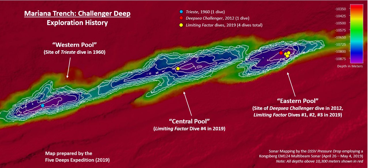
This map was created by the DSSV Pressure Drop's Kngsberg EM124 sonar system over the course of two weeks to map the Challenger Deep in the Marianas Trench. The Deep consists of three "pools" of varying depth with the central pool being the most shallow, then the western one, with the eastern pool measured to be the deepest at 10,925 meters. That depth was measured using the manned submersible DSV Limiting Factor on April 28 - May 3, 2019 as part of the Five Deeps Expedition.
Licencja:
Warunki licencji:
Creative Commons Attribution-Share Alike 4.0
Więcej informacji o licencji można znaleźć tutaj. Ostatnia aktualizacja: Sat, 08 Oct 2022 19:47:38 GMT