Cooch-behar-enclaves-schematisch
Autor:
Attribution:
Obraz jest oznaczony jako „Wymagane uznanie autorstwa” (attribution required), ale nie podano żadnych informacji o uznaniu autorstwa. Prawdopodobnie parametr atrybucji został pominięty podczas korzystania z szablonu MediaWiki dla licencji CC-BY. Autorzy mogą znaleźć tutaj przykład prawidłowego korzystania z szablonów.
Credit:
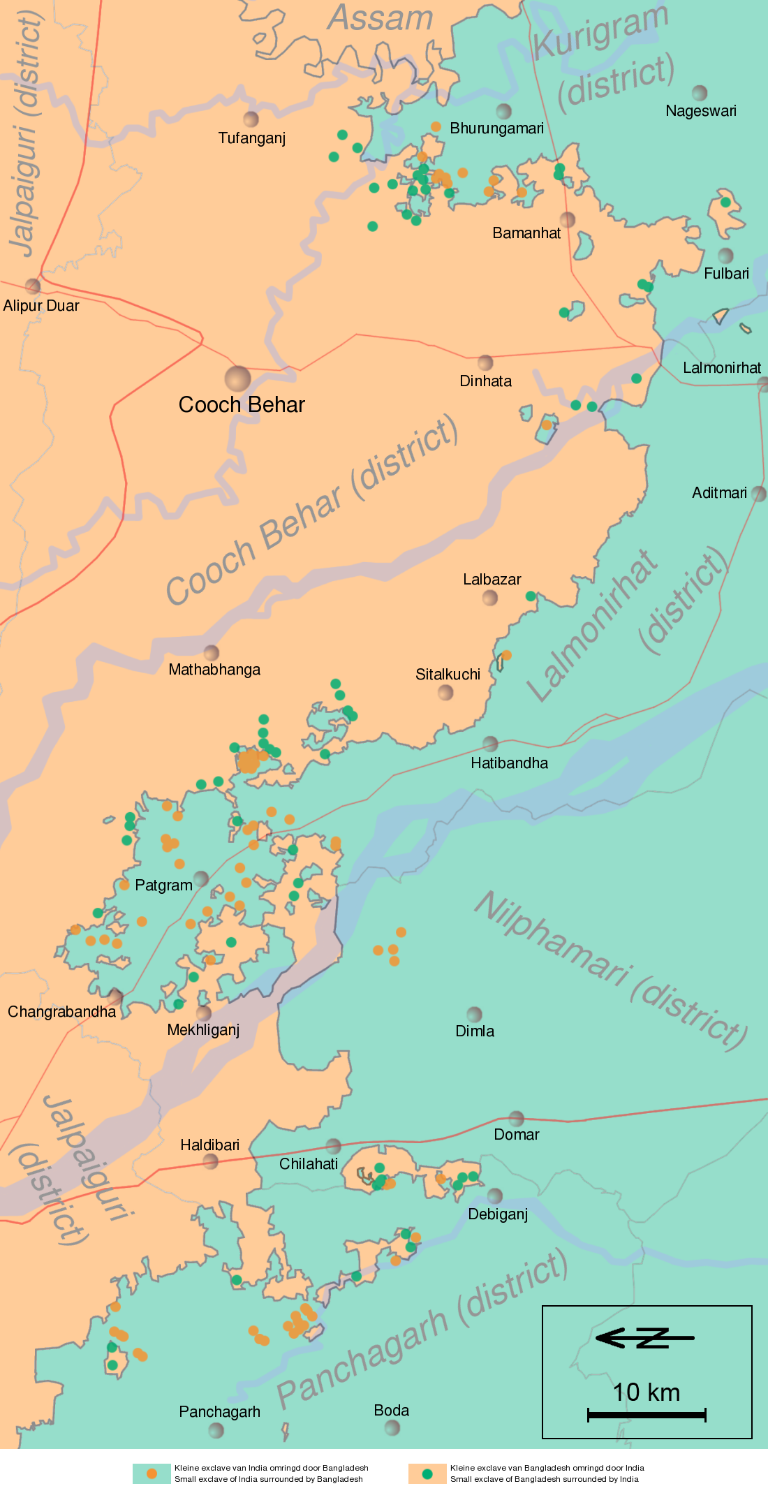
Information in "Waiting for the esquimo: An historical and documentary study of the Cooch Behar enclaves of India and Bangladesh" door Brendan R. Whyte (2002), [1], Google Maps and other map sources
![[1]](http://geosite.jankrogh.com/enklaver/CoochBehar_Annotated.jpg)
Krótki link:
źródło:
Wymiary:
1100 x 2148 Pixel (710575 Bytes)
Opis:
Schematic map of the Cooch Behar enclaves on the border of India and Bangladesh. The top of the map points to the east.
Licencja:
Warunki licencji:
Creative Commons Attribution-Share Alike 3.0
Więcej informacji o licencji można znaleźć tutaj. Ostatnia aktualizacja: Mon, 07 Nov 2022 20:10:05 GMT