Dardanelles defences 1915
Autor:
Credit:
Praca własna
Krótki link:
źródło:
Wymiary:
600 x 620 Pixel (139877 Bytes)
Opis:
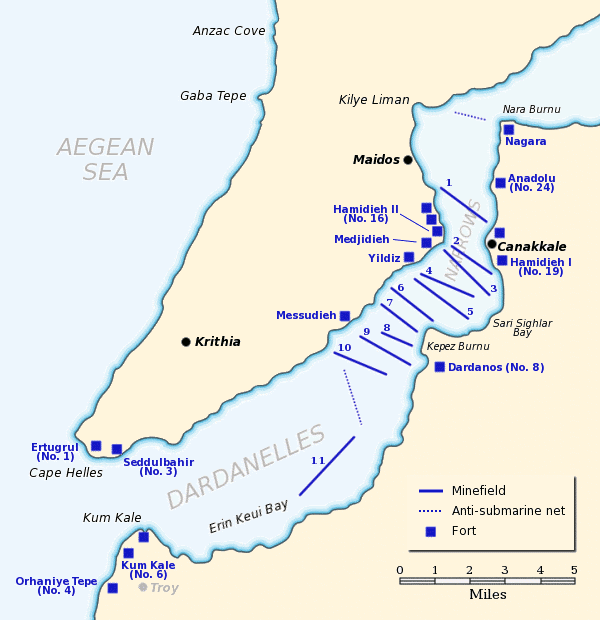
Map of the Dardanelles defences in February and March, 1915. The original lines of naval mines are numbered 1 to 10. The 11th line, laid in Erin Keui Bay by the minelayer Nusrat on 8 March, is numbered 11. The anti-submarine nets are shown as dotted lines. Major forts are indicated with blue boxes and the Turkish name and equivalent British number for the fort is given, if known.
Based on a maps from:
- A Short Military History of World War I - Atlas, edited by T. Dodson Stamps and Vincent J. Esposito, 1950
- Gallipoli: A Battlefield Guide, Phil Taylor & Pam Cupper, 1989
- Gallipoli, Les Carlyon, 2001.
Licencja:
Public domain
Komentarz do licencji:
Released to public domain
Więcej informacji o licencji można znaleźć tutaj. Ostatnia aktualizacja: Tue, 27 Sep 2022 21:27:38 GMT