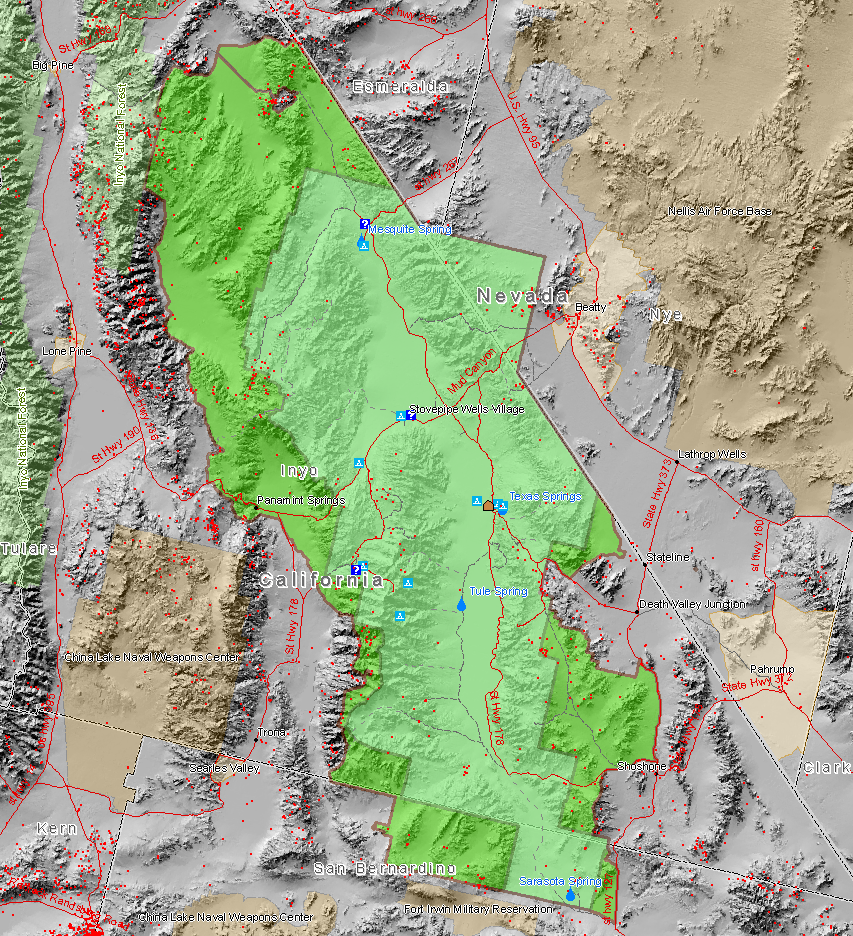
Death Valley NP master map
Autor:
user:maveric149 (Daniel Mayer)
Attribution:
Obraz jest oznaczony jako „Wymagane uznanie autorstwa” (attribution required), ale nie podano żadnych informacji o uznaniu autorstwa. Prawdopodobnie parametr atrybucji został pominięty podczas korzystania z szablonu MediaWiki dla licencji CC-BY. Autorzy mogą znaleźć tutaj przykład prawidłowego korzystania z szablonów.
Credit:
Map created by Daniel Mayer using data from the National Park Service metadata
Krótki link:
źródło:
Wymiary:
853 x 936 Pixel (973337 Bytes)
Opis:
Map of the Death Valley National Park showing surrounding area and the previous smaller extent of the Park. Red dots are mine sites, blue triangles are camp sites, and blue question marks are tourist information facilities. This map also shows the old borders of Death Valley National Monument and the new borders of the expanded national park.
Licencja:
Komentarz do licencji:
Ja, właściciel praw autorskich do tego dzieła, udostępniam je na poniższej licencji
Warunki licencji:
Creative Commons Attribution-Share Alike 2.5
Więcej informacji o licencji można znaleźć tutaj. Ostatnia aktualizacja: Sat, 06 Nov 2021 05:30:44 GMT