English regions and counties by type 2019
Autor:
- English_metropolitan_and_non-metropolitan_counties_2010.svg: Nilfanion
- Derivative work: Dr Greg, The Equalizer
Credit:

Krótki link:
źródło:
Wymiary:
4617 x 5604 Pixel (847226 Bytes)
Opis:
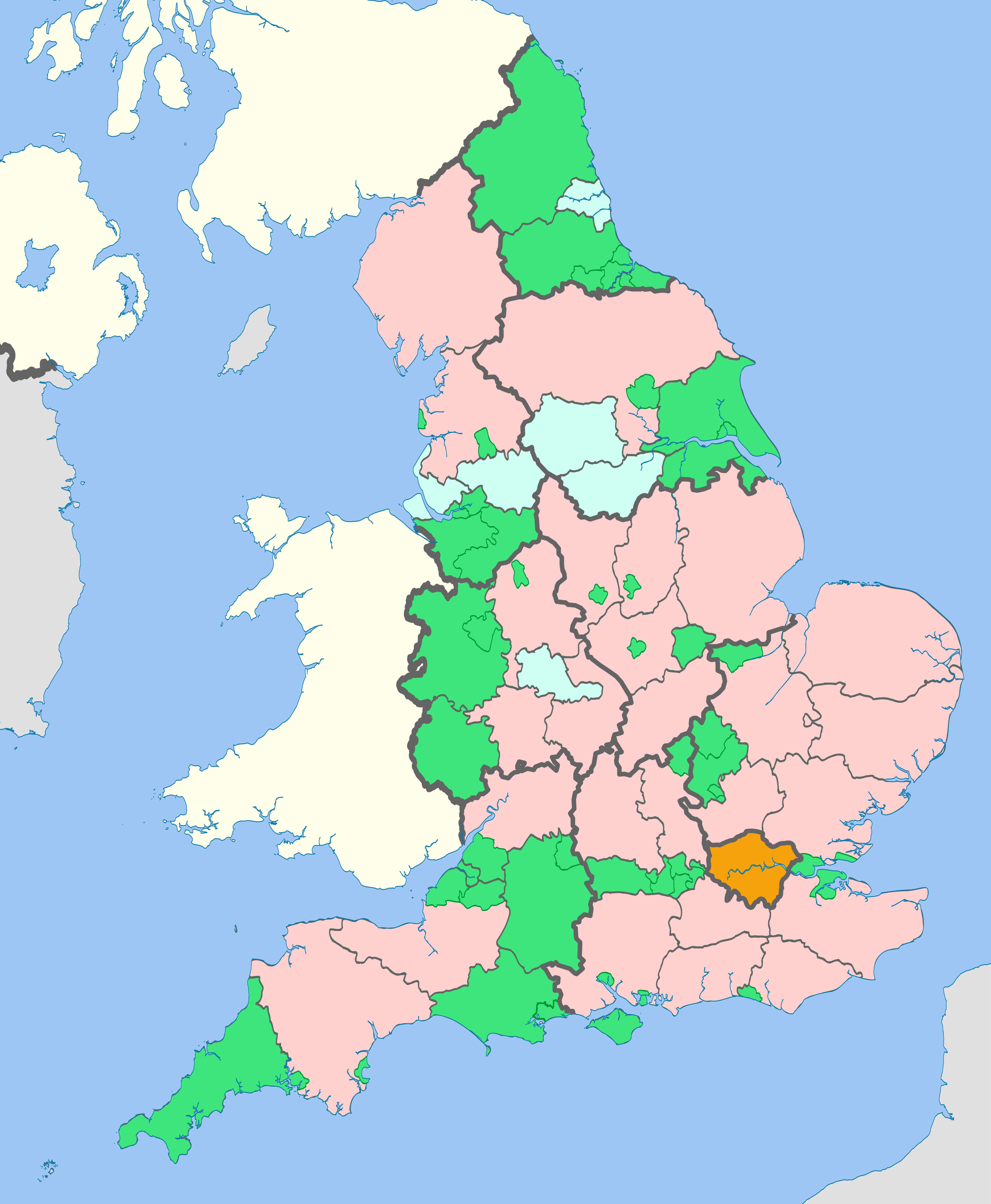
Map showing the Regions of England and the constituent metropolitan and non-metropolitan counties in 2019.
Equirectangular map projection on WGS 84 datum, with N/S stretched 170% Geographic limits:
- West: 6.75W
- East: 2.0E
- North: 56.0N
- South: 49.75N
regional boundary
ceremonial county boundary
two-tier non-metropolitan county
unitary authority| (non-metropolitan county)
Licencja:
Warunki licencji:
Creative Commons Attribution-Share Alike 4.0
Więcej informacji o licencji można znaleźć tutaj. Ostatnia aktualizacja: Fri, 28 Oct 2022 02:05:05 GMT