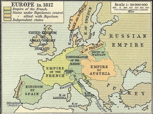
Europe in 1812
Autor:
Credit:
Historical Atlas. New York: Henry Holt and Company
copy available at http://www.lib.utexas.edu/maps/historical/history_shepherd_1911.html
Krótki link:
źródło:
Wymiary:
536 x 399 Pixel (469482 Bytes)
Opis:
Political map of Europe in 1812, showing boundaries immediately prior to Napoleon's invasion of Russia
Licencja:
Public domain
Więcej informacji o licencji można znaleźć tutaj. Ostatnia aktualizacja: Wed, 09 Nov 2022 05:38:30 GMT