Falaise Pocket German Counterattack
Autor:
Credit:
Own work by uploader from Mémorial de Coudehard - Montormel, the memorial website for the battle.
Krótki link:
źródło:
Wymiary:
800 x 577 Pixel (227695 Bytes)
Opis:
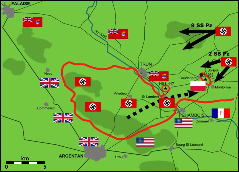
Map of German counterattacks, 20 August 1944, on Polish position on Hill 262, north-east of Chambois, Falaise Pocket, Normandy
Licencja:
Public domain
Więcej informacji o licencji można znaleźć tutaj. Ostatnia aktualizacja: Thu, 29 Dec 2022 07:27:59 GMT