Flood Basalt Map
Autor:
Attribution:
Obraz jest oznaczony jako „Wymagane uznanie autorstwa” (attribution required), ale nie podano żadnych informacji o uznaniu autorstwa. Prawdopodobnie parametr atrybucji został pominięty podczas korzystania z szablonu MediaWiki dla licencji CC-BY. Autorzy mogą znaleźć tutaj przykład prawidłowego korzystania z szablonów.
Credit:
Praca własna - based on markup of Source: https://earthquake.usgs.gov/research/structure/crust/maps.php ; original upload english wikipedia 22 April 2005 by SEWilco. The source figure is in the public domain because it contains materials that originally came from the United States Geological Survey, an agency of the United States Department of Interior. For more information, see the official USGS copyright policy.

Krótki link:
źródło:
Wymiary:
1152 x 720 Pixel (140830 Bytes)
Opis:
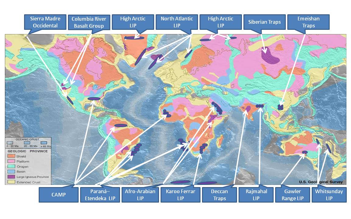
This file is an identification of large igneous provinces overlaid on a map produced by United States National Oceanic and Atmosphere Administration's National Geophysical Data Center. Intended for use in the Large igneous province page.
Licencja:
Warunki licencji:
Creative Commons Attribution-Share Alike 3.0
Więcej informacji o licencji można znaleźć tutaj. Ostatnia aktualizacja: Sat, 07 Aug 2021 01:43:11 GMT