General Government for the occupied Polish territories (1941)
Autor:
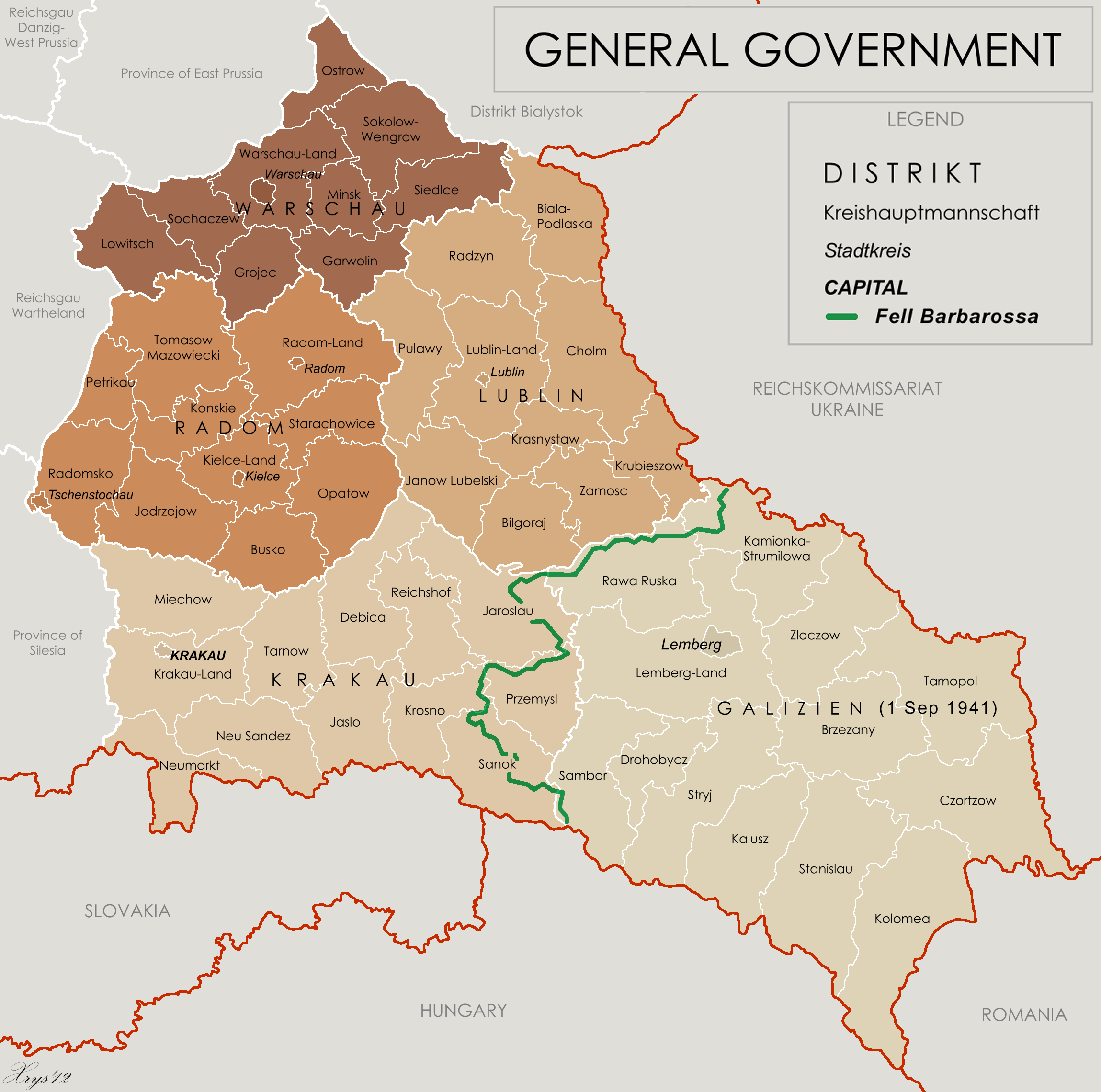
XrysD and User:Poeticbent (the 1941 demarkation line and legend)
Attribution:
Obraz jest oznaczony jako „Wymagane uznanie autorstwa” (attribution required), ale nie podano żadnych informacji o uznaniu autorstwa. Prawdopodobnie parametr atrybucji został pominięty podczas korzystania z szablonu MediaWiki dla licencji CC-BY. Autorzy mogą znaleźć tutaj przykład prawidłowego korzystania z szablonów.
Credit:
Praca własna by XrysD, edited by Poeticbent with superimposed German-Soviet border before Operation Barbarossa. Sources at: File:Generalne gubernatorstwo 1945.png and File:Western portions of the Ukrainian SSR 1940.jpg
A published source with the same information is Musial, Bogdan (2000) (niemiecki) Deutsche Zivilverwaltung und Judenverfolgung im Generalgouvernement: eine Fallstudie zum Distrikt Lublin 1939-1944, Otto Harrassowitz Verlag, s. 424 ISBN: 978-3-447-05063-0.
Krótki link:
źródło:
.png?uselang=pl)
Wymiary:
2299 x 2280 Pixel (556541 Bytes)
Opis:
Map of the administrative areas of the General Government
Licencja:
Warunki licencji:
Creative Commons Attribution-Share Alike 3.0
Więcej informacji o licencji można znaleźć tutaj. Ostatnia aktualizacja: Thu, 15 Dec 2022 00:33:28 GMT