Han dynasty Kingdoms 195 BC
Autor:
Attribution:
Obraz jest oznaczony jako „Wymagane uznanie autorstwa” (attribution required), ale nie podano żadnych informacji o uznaniu autorstwa. Prawdopodobnie parametr atrybucji został pominięty podczas korzystania z szablonu MediaWiki dla licencji CC-BY. Autorzy mogą znaleźć tutaj przykład prawidłowego korzystania z szablonów.
Credit:
Praca własna przy użyciu
- Zhou Zhenhe (1987). Xihan Zhengqu Dili [Administrative Geography of the Western Han Dynasty] (in Chinese). Beijing: People's Press. ISBN 9787100128988, pp. 11–15.
Krótki link:
źródło:
Wymiary:
1483 x 1677 Pixel (753863 Bytes)
Opis:
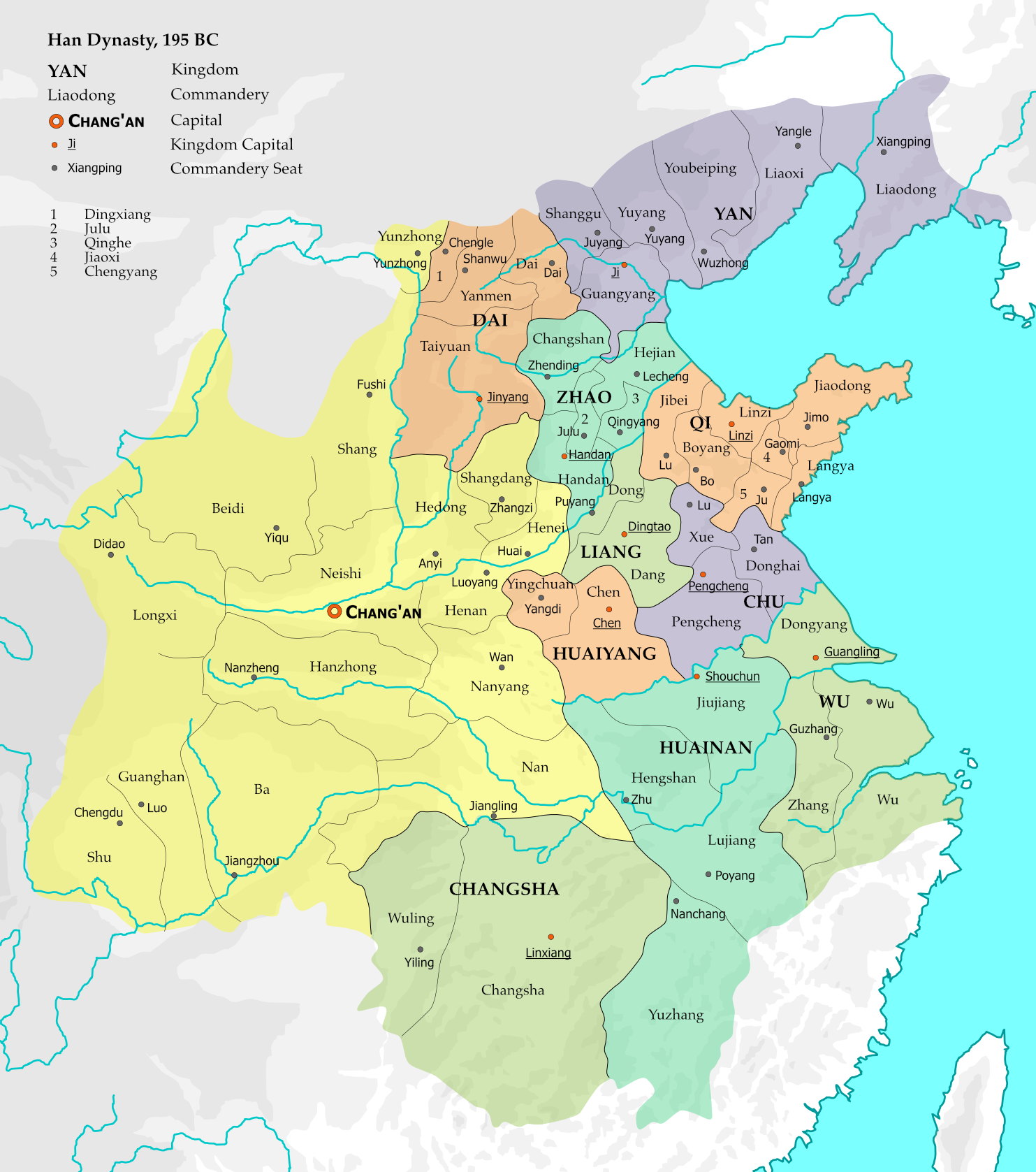
The map represents the situation of Western Han dynasty in the 12th year of Emperor Gao (195 BC). 10 kingdoms existed within the Han empire at the time, and with the exception of Changsha, all are headed by members of the imperial family. 15 commanderies in the central and western parts of the empire were directly administered by the imperial government.
The borders are based on Zhou Zhenhe's Xihan Zhengqu Dili (西汉政区地理, "Administrative Geography of Western Han"), 1987.
Licencja:
Warunki licencji:
Creative Commons Attribution-Share Alike 4.0
Więcej informacji o licencji można znaleźć tutaj. Ostatnia aktualizacja: Fri, 16 Dec 2022 07:46:07 GMT