High Asia Mountain Ranges
Autor:
- Hindu_Kush_satellite_image.jpg: Jeff Schmaltz, MODIS Land Rapid Response Team at NASA GSFC
- derivative work: Rupert Pupkin
Credit:
Krótki link:
źródło:
Wymiary:
5600 x 4400 Pixel (11315921 Bytes)
Opis:
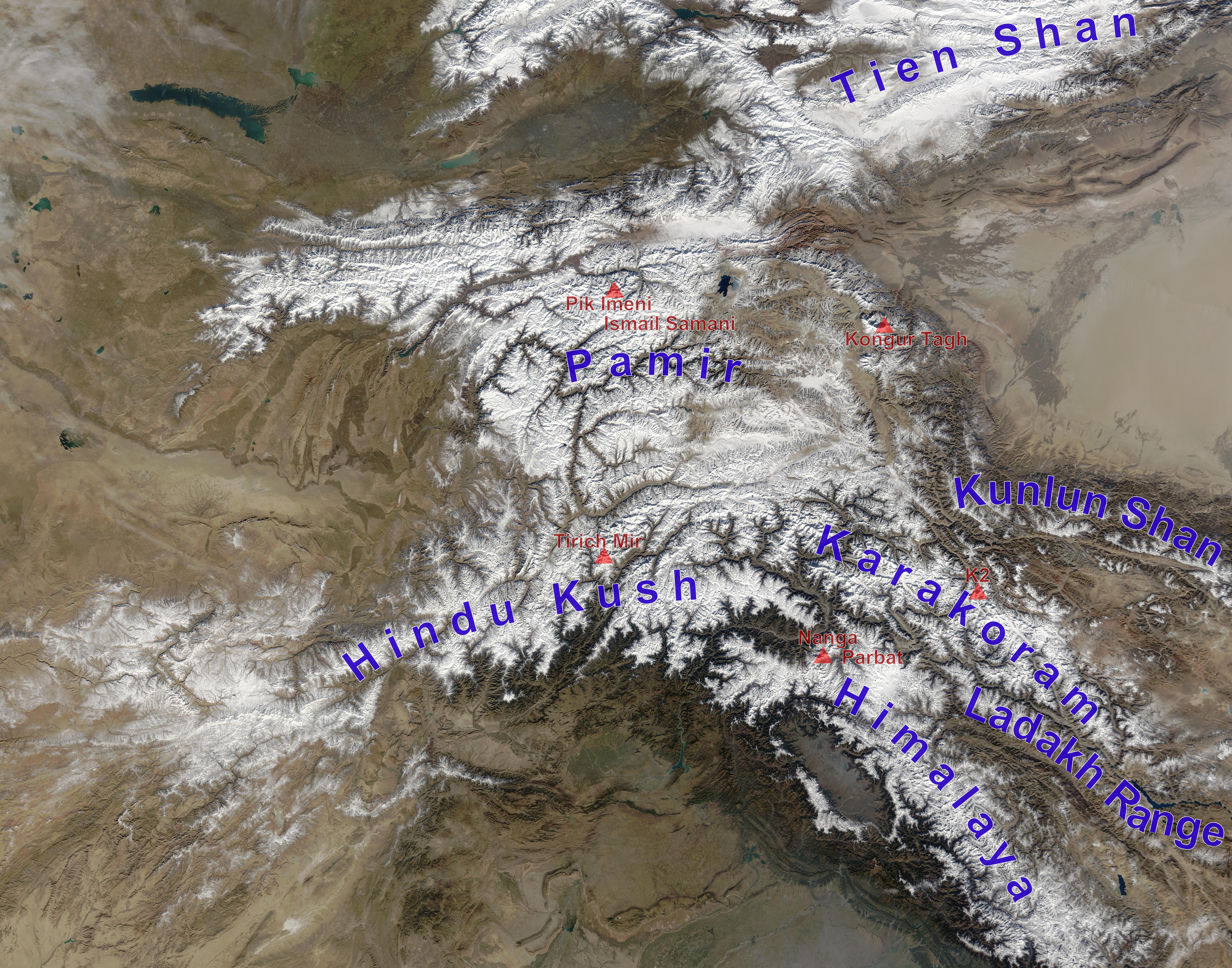
high Asian mountain ranges and their highest mountains:
- Tien Shan – Jengish Chokusu is outside the picture,
- Kunlun Shan – Kongur Tagh. Note: Some sources count Kongur to the Pamirs. Liushi Shan, the highest mountain of Kunlun Shan not counting Kongur is outside the picture
- Pamir – Kongur Tagh (if not counted to Kunlun Shan), Pik Imeni Ismail Samani (if Kongur belongs to Kunlun Shan)
- Hindu Kush – Tirich Mir >> HERE MISTAKE IN THE MAP: The last 2½ letters of "Hindu Kush" are in the Hindu Raj mountain range which spread out eastwards to the huge S-shaped Indus valley (crossing the first letter of "Nanga Parbat")
- Karakoram – K2
- Himalayas – Nanga Parbat is the highest mountain of the western Himalayas, there are of course seven higher Eightthousanders in the eastern Himalayas
- Ladakh Range – no prominent high peak labelled
Licencja:
Public domain
Więcej informacji o licencji można znaleźć tutaj. Ostatnia aktualizacja: Tue, 19 Oct 2021 12:15:45 GMT