IrishSeaReliefMap
Autor:
Attribution:
Obraz jest oznaczony jako „Wymagane uznanie autorstwa” (attribution required), ale nie podano żadnych informacji o uznaniu autorstwa. Prawdopodobnie parametr atrybucji został pominięty podczas korzystania z szablonu MediaWiki dla licencji CC-BY. Autorzy mogą znaleźć tutaj przykład prawidłowego korzystania z szablonów.
Credit:
old map: http://www.vindaloo.uklinux.net/jjg/code/tmutils.html-> new map: Maps for Free and Praca własna
Krótki link:
źródło:
Wymiary:
1043 x 1507 Pixel (2250479 Bytes)
Opis:
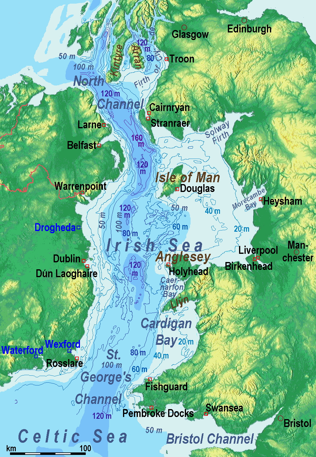
A map of the en:Irish Sea. Major ports shown with red marks. freight-only ports in blue.
The old map with this lemma had significant mistakes of the bathymetry.
Licencja:
Komentarz do licencji:
old map: from http://www.vindaloo.uklinux.net/jjg/code/tmutils.html. Released to public domain by creator.
Warunki licencji:
Creative Commons Attribution-Share Alike 3.0
Więcej informacji o licencji można znaleźć tutaj. Ostatnia aktualizacja: Tue, 13 Dec 2022 19:49:06 GMT