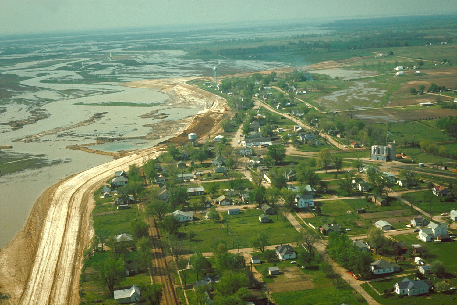
Keyesport Illinois with Carlyle Lake filling
Autor:
U.S. Army Corps of Engineers, photographer not specified or unknown
Credit:
U.S. Army Corps of Engineers Digital Visual Library
Image page
Image description page
Digital Visual Library home page
Image page
Image description page
Digital Visual Library home page
Krótki link:
źródło:
Wymiary:
1500 x 1000 Pixel (293530 Bytes)
Opis:
Aerial view of Keyesport, Illinois, USA. The photograph was taken in 1967 or 1968 after the Carlyle Lake Dam had been completed and Carlyle Lake was filling. The town now lies directly on the lakeshore.
Licencja:
Public domain
Komentarz do licencji:
This image or file is a work of a U.S. Army Corps of Engineers soldier or employee, taken or made as part of that person's official duties. As a work of the U.S. federal government, the image is in the public domain.
Więcej informacji o licencji można znaleźć tutaj. Ostatnia aktualizacja: Mon, 04 Apr 2022 20:49:59 GMT