Lake bonneville map

Autor:
Attribution:
Obraz jest oznaczony jako „Wymagane uznanie autorstwa” (attribution required), ale nie podano żadnych informacji o uznaniu autorstwa. Prawdopodobnie parametr atrybucji został pominięty podczas korzystania z szablonu MediaWiki dla licencji CC-BY. Autorzy mogą znaleźć tutaj przykład prawidłowego korzystania z szablonów.
Credit:
Praca własna.
- Based on this map by Laura DeGrey, Myles Miller and Paul Link of Idaho State University, Dept. of Geosciences.
- Inset North America map from File:America-blank-map-01.svg
- Lakes in Western Great Basin sourced from USGS, Extent of Pleistocene Lakes in the Western Great Basin by Marith Reheis, 1999.
- Further sourced from SERC, Carleton College, Reheis and Bright, 2009.
- Coastline based on The Pacific Northwest Coast: Living With the Shores of Washington and Oregon, Paul D. Komar and USGS map.
|
|
Krótki link:
źródło:
Wymiary:
663 x 570 Pixel (360096 Bytes)
Opis:
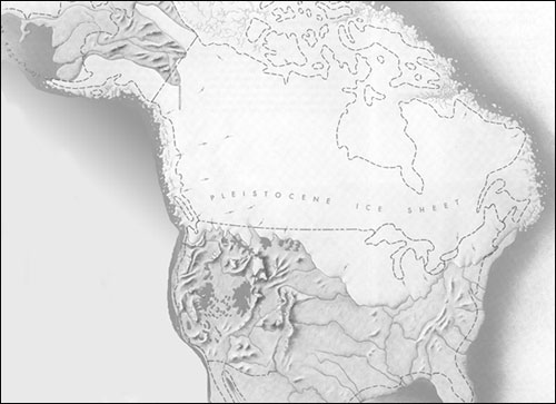
Pleistocene epoch map showing the extent of the Lake Bonneville Flood and Pleistocene lakes in northwestern United States around 14.5000 radiocarbon years (~17,500 calendar years) before present.
Licencja:
Warunki licencji:
Creative Commons Attribution-Share Alike 3.0
Więcej informacji o licencji można znaleźć tutaj. Ostatnia aktualizacja: Mon, 25 Jul 2022 23:04:45 GMT