Mexico & Guatimala
Autor:
Krótki link:
źródło:
.jpg?uselang=pl)
Wymiary:
1357 x 1173 Pixel (1006933 Bytes)
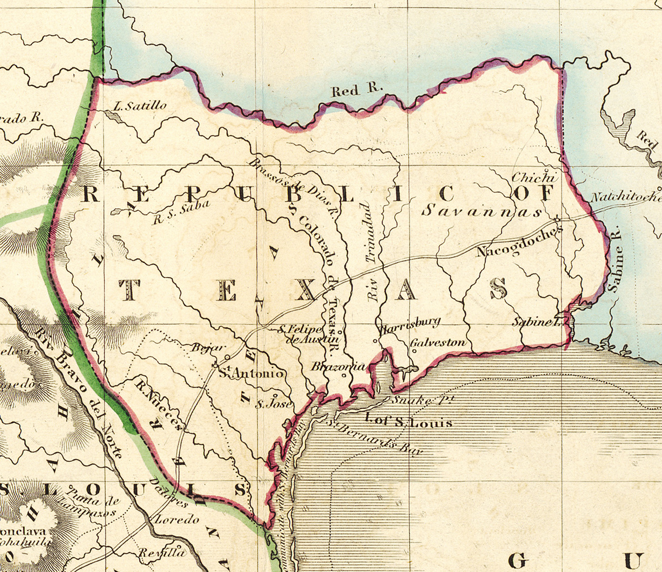
Opis:
Shortly after Texas declared its independence from Mexico in 1836, the Edinburgh painter, engraver, printer, cartographer, lithographer, and publisher William Home Lizars (1788-1859), brother of Daniel Lizars II (1793-1875) updated the original plate for the map of Mexico & Guatemala to include the new republic. He added the towns of Galveston, Harrisburg, Brazoria, S. Felipe de Austin (although recently destroyed), Bejar, and "S. Jose" (probably intended to represent Goliad). Lizars made no further improvements to the general cartographic shape of the republic except to show the Nueces River as the southern boundary and the western boundary curving to the point where the 100th meridian strikes the Red River. The map continues to show Mexico's administrative districts as Spanish Intendencies (Intendencias) and Internal Provinces (Provincias Internas) over fifteen years since Mexico's independence.
Licencja:
Public domain
Więcej informacji o licencji można znaleźć tutaj. Ostatnia aktualizacja: Fri, 13 Jan 2023 09:13:48 GMT