Map Gaels Brythons Picts
Autor:
Attribution:
Obraz jest oznaczony jako „Wymagane uznanie autorstwa” (attribution required), ale nie podano żadnych informacji o uznaniu autorstwa. Prawdopodobnie parametr atrybucji został pominięty podczas korzystania z szablonu MediaWiki dla licencji CC-BY. Autorzy mogą znaleźć tutaj przykład prawidłowego korzystania z szablonów.
Credit:
Own work, based on File:Uk map home nations.png
Krótki link:
źródło:
Wymiary:
643 x 829 Pixel (67122 Bytes)
Opis:
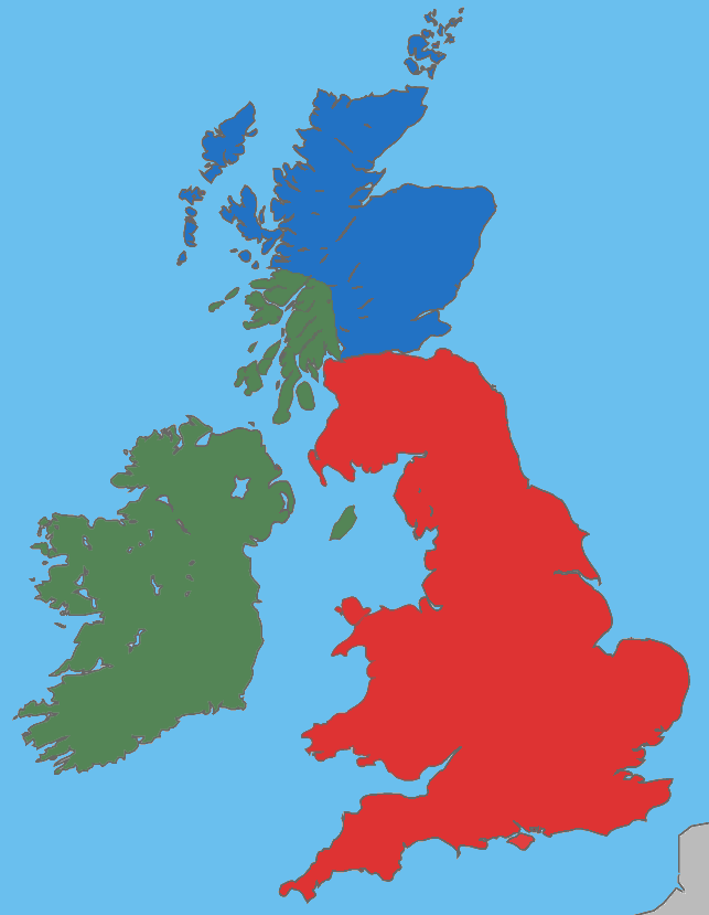
A map showing the approximate areas where the Gaelic (green), Brythonic (red) and Pictish (blue) languages were spoken during the 5th century CE; the period between the Roman withdrawal and the founding of Anglo-Saxon kingdoms.
Licencja:
Warunki licencji:
Creative Commons Attribution-Share Alike 4.0
Więcej informacji o licencji można znaleźć tutaj. Ostatnia aktualizacja: Sat, 05 Mar 2022 00:19:22 GMT