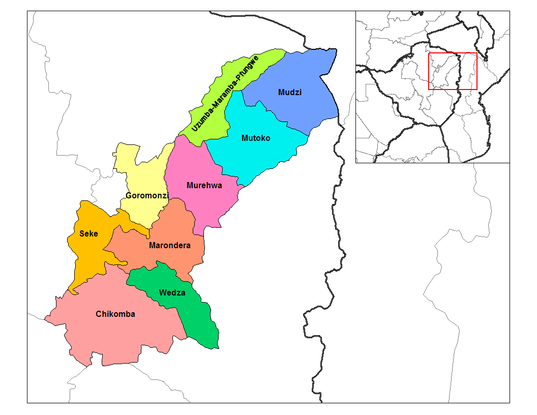
Mashonaland East districts
Autor:
Credit:
Praca własna (Rarelibra) using MapInfo Professional v8.5 and various mapping resources.
Transferred from en.wikipedia
Transferred from en.wikipedia
Krótki link:
źródło:
Wymiary:
1056 x 816 Pixel (40343 Bytes)
Opis:
Map of the districts of Mashonaland East province of Zimbabwe.
Licencja:
Public domain
Więcej informacji o licencji można znaleźć tutaj. Ostatnia aktualizacja: Fri, 30 Sep 2022 17:36:48 GMT