Miranda2
Autor:
NASA/JPL
Krótki link:
źródło:
Wymiary:
1201 x 1093 Pixel (147864 Bytes)
Opis:
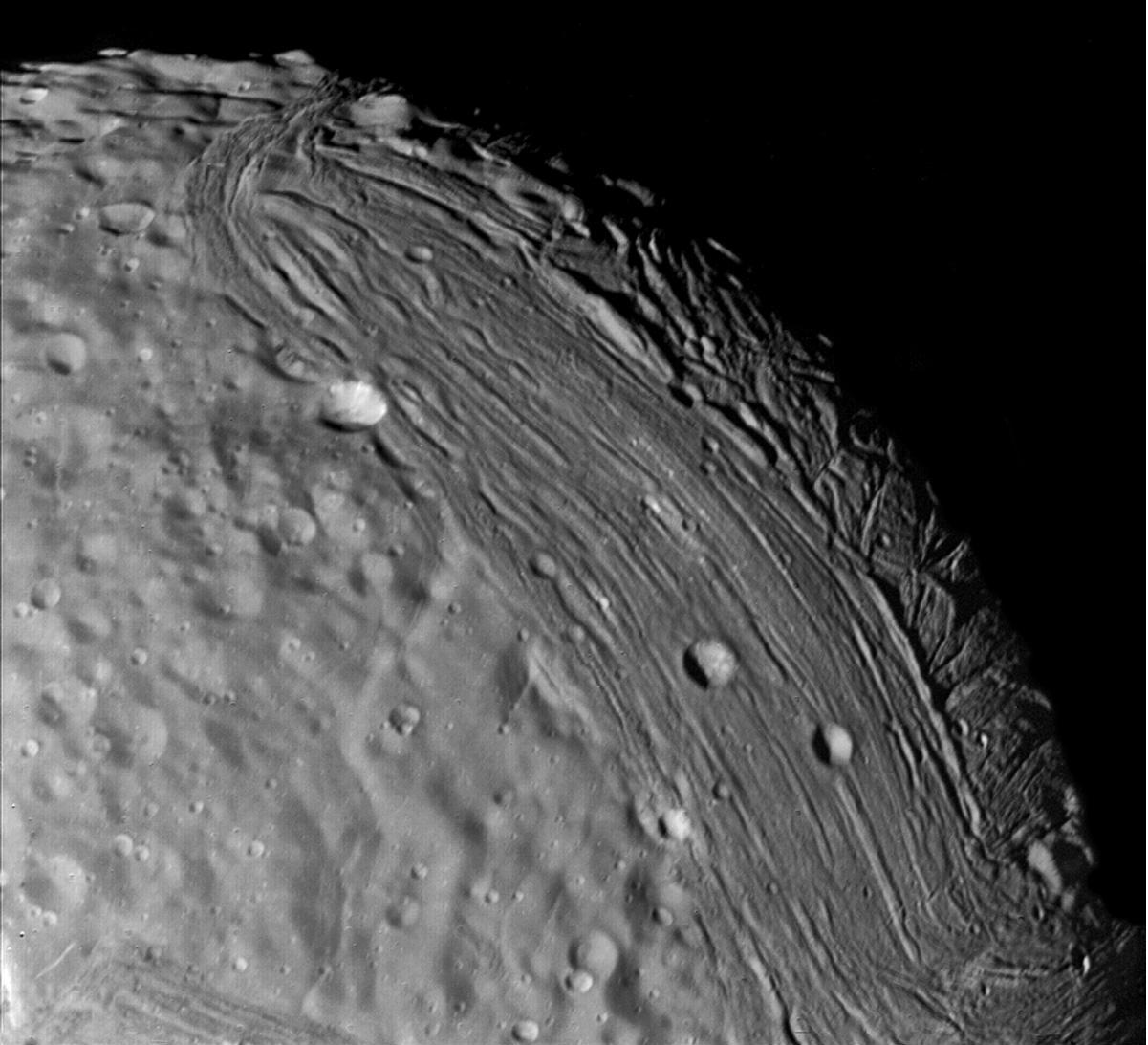
Miranda reveals a complex geologic history in this view, acquired by Voyager 2 on January 24, 1986, around its close approach to the Uranian moon. At least three terrain types of different age and geologic style are evident at this resolution of about 700 meters (2,300 feet). Visible in this clear-filter, narrow-angle image are, from left: (1) an apparently ancient, cratered terrain consisting of rolling, subdued hills and degraded medium-sized craters (2) a grooved terrain with linear valleys and ridges developed at the expense of, or replacing, the first terrain type: and (3) a complex terrain seen along the terminator, in which intersecting curvilinear ridges and troughs are abruptly truncated by the linear, grooved terrain. Voyager scientists believe this third terrain type is intermediate in age between the first two.
Licencja:
Public domain
Komentarz do licencji:
| Ten plik jest w domenie publicznej ponieważ został stworzony przez NASA. Polityka praw autorskich NASA stwierdza, że „materiały NASA nie są chronione prawami autorskimi, chyba że zapisano inaczej”. (NASA copyright policy lub JPL Image Use Policy). | ||
 |
Uwaga:
|
Więcej informacji o licencji można znaleźć tutaj. Ostatnia aktualizacja: Tue, 22 Nov 2022 18:21:46 GMT