Mohomap
Autor:
Attribution:
Obraz jest oznaczony jako „Wymagane uznanie autorstwa” (attribution required), ale nie podano żadnych informacji o uznaniu autorstwa. Prawdopodobnie parametr atrybucji został pominięty podczas korzystania z szablonu MediaWiki dla licencji CC-BY. Autorzy mogą znaleźć tutaj przykład prawidłowego korzystania z szablonów.
Credit:
Praca własna
Krótki link:
źródło:
Wymiary:
3282 x 1821 Pixel (278285 Bytes)
Opis:
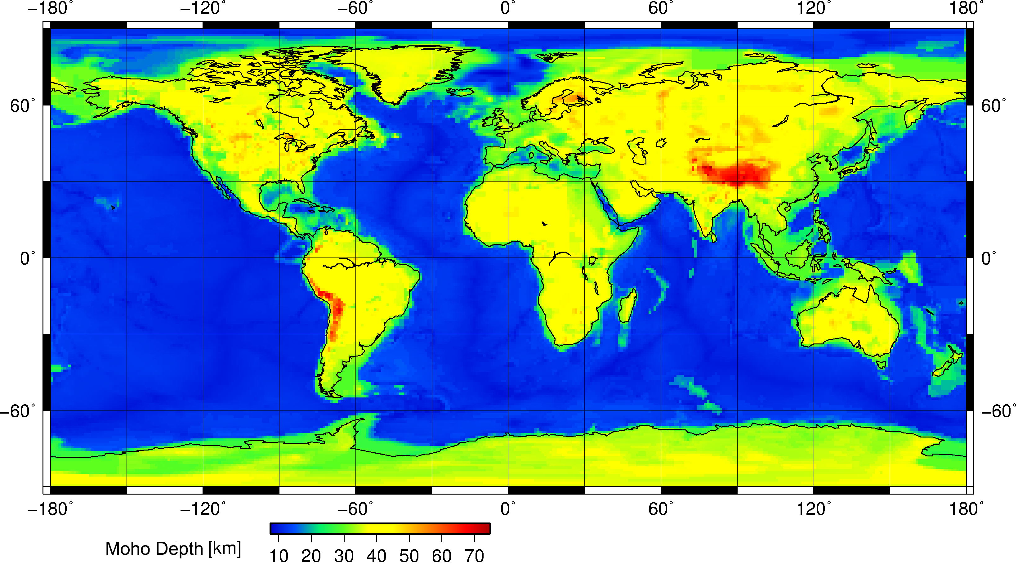
This is a geophysical map showing the position of the Moho discontinuity across the Earth. The Moho is the boundary between the Earth's crust and the mantle. Search "Mohorovičić discontinuity" for more information.
This map was constructed using the Crust 1.0 model and Generic Mapping Tools (GMT) for Linux. It was done at the Christian-Albrechts University of Kiel, Germany.
Licencja:
Warunki licencji:
Creative Commons Attribution-Share Alike 3.0
Więcej informacji o licencji można znaleźć tutaj. Ostatnia aktualizacja: Fri, 28 Oct 2022 12:23:40 GMT