Ohio Country en
Autor:
Credit:
Own work by Nikater, submitted to the public domain. Background map courtesy of Demis, www.demis.nl and Wilcomb E. Washburn (Hrsg.) Handbook of North American Indians. Vol. 4: History of Indian-White Relations. Smithsonian Institution Press, Washington D.C. 1988. ISBN 0-16004-583-5
Krótki link:
źródło:
Wymiary:
1217 x 920 Pixel (1477590 Bytes)
Opis:
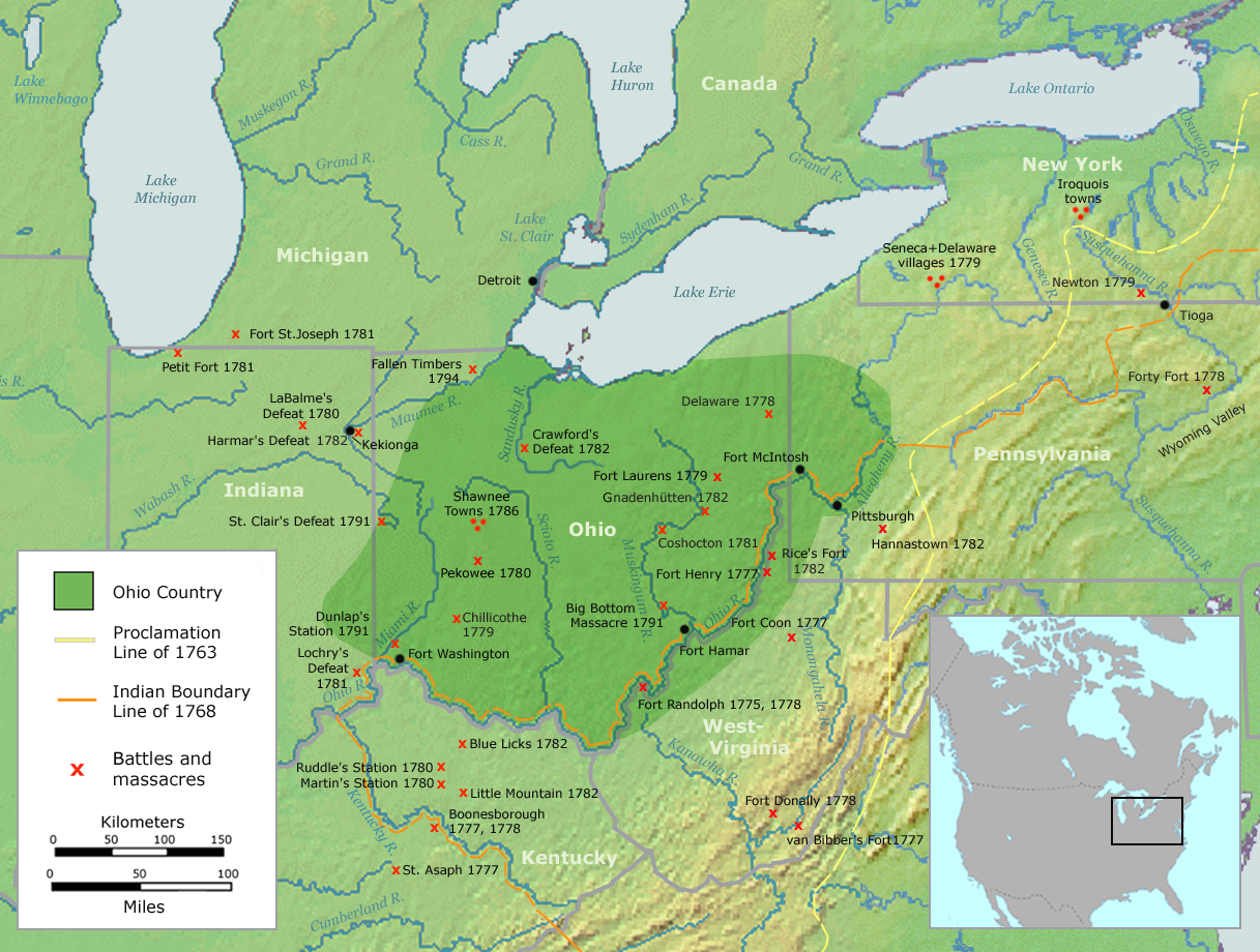
Map of the Ohio Country (English version)
Licencja:
Public domain
Komentarz do licencji:
This image is in the public domain because it came from the site https://www.demis.nl/products/web-map-server/examples/ and was released by the copyright holder. Permission is granted to copy, distribute and/or modify this map since it is based on free of copyright images from: www.demis.nl. See also approval email on de.wp and its clarification.
Więcej informacji o licencji można znaleźć tutaj. Ostatnia aktualizacja: Mon, 31 Oct 2022 02:30:59 GMT