Santa monica mountains canyon
Autor:
Oryginalnym przesyłającym był Geographer z angielskiej Wikipedii
Attribution:
Obraz jest oznaczony jako „Wymagane uznanie autorstwa” (attribution required), ale nie podano żadnych informacji o uznaniu autorstwa. Prawdopodobnie parametr atrybucji został pominięty podczas korzystania z szablonu MediaWiki dla licencji CC-BY. Autorzy mogą znaleźć tutaj przykład prawidłowego korzystania z szablonów.
Credit:
Krótki link:
źródło:
Wymiary:
1224 x 1632 Pixel (1071210 Bytes)
Opis:
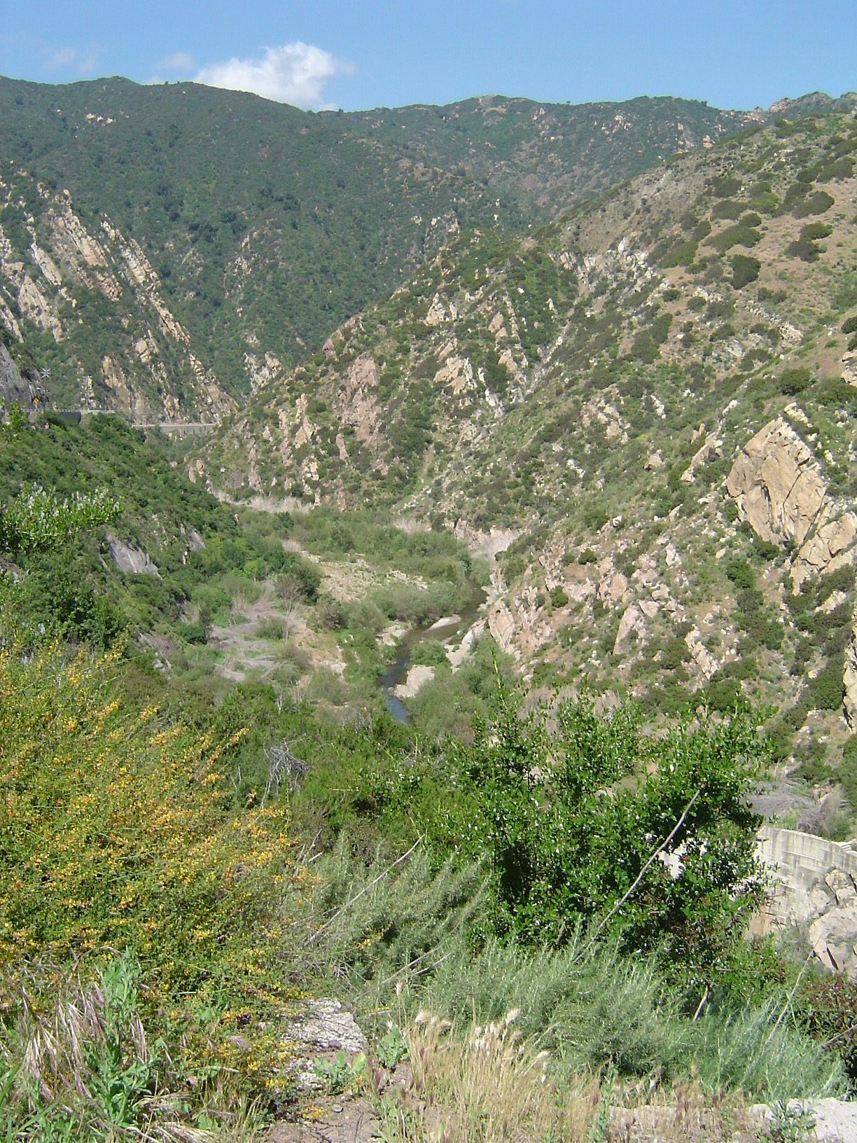
Malibu Canyon — looking north (upstream), in Malibu Creek State Park, Los Angeles County, California.
- Malibu Creek formed the canyon as it eroded through sedimentary layers as they were tilted upward to form the Santa Monica Mountains and thus it is older than the range itself. The Rindge Dam is visible at lower right, partly hidden by a Ceanothus bush. The dam was built by the owners of the Malibu Ranch (present day Malibu) in the early 20th century. It is now full of silt and serves no purpose while blocking the runs of endangered steelhead trout and is presently slated for removal.
- The common chaparral plants in the foreground are gray fine-leaved California sagebrush (Artemisia californica), and colorful Deerweed, (Lotus scoparius). This canyon burned in a brush fire in 1993, ten years prior to the photograph.
- Credits
Photographed and uploaded by user:Geographer.
- Taken April 26, 2003.
Licencja:
Warunki licencji:
Creative Commons Attribution 1.0
Więcej informacji o licencji można znaleźć tutaj. Ostatnia aktualizacja: Thu, 24 Nov 2022 18:57:43 GMT