Seto-Inland-Sea-Photo
Autor:
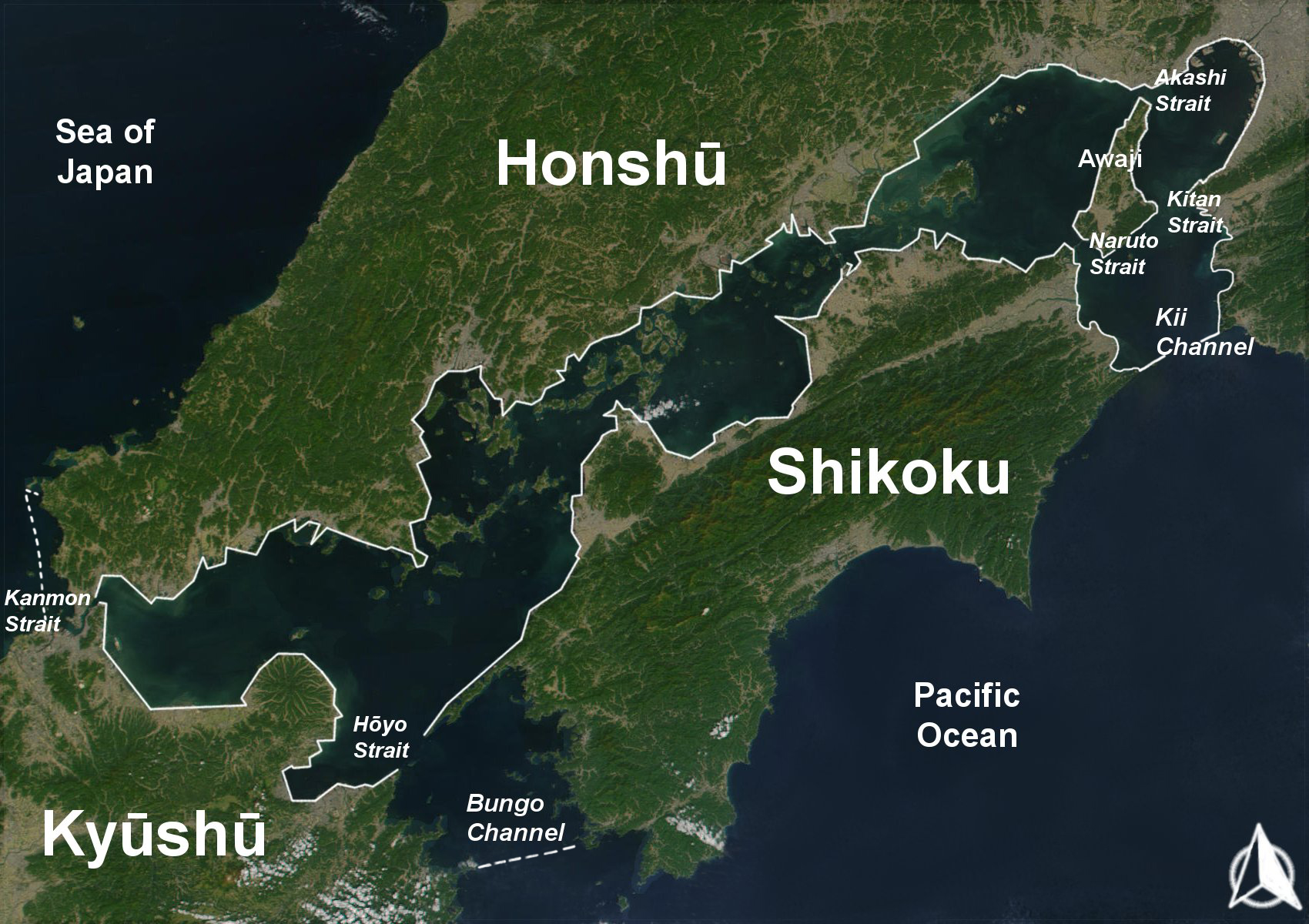
User:Guenny (Christian Günther) made this map of the Japanese Inland Sea (Setonaikai,瀬戸内海) for the German Wikipedia. de:Seto-Inlandsee. It's showing the Japanese islands surrounding the sea with the major straits and channels. Guenny is willing to do translations to other languages if needed, as well as corrections and enhancements.
Attribution:
Obraz jest oznaczony jako „Wymagane uznanie autorstwa” (attribution required), ale nie podano żadnych informacji o uznaniu autorstwa. Prawdopodobnie parametr atrybucji został pominięty podczas korzystania z szablonu MediaWiki dla licencji CC-BY. Autorzy mogą znaleźć tutaj przykład prawidłowego korzystania z szablonów.
Credit:
Based on a Public-Domain-Satellite photo of NASA
Krótki link:
źródło:
Wymiary:
1700 x 1200 Pixel (967202 Bytes)
Opis:
The Range of the Seto Inland Sea by the Territorial Sea Law (領海及び接続水域に関する法律) is 19,700 km2 (solid lines). Reference: Seto_Inland_Sea01.png . The Range of the Seto Inland Sea according to the Setouchi Law and the Setouchi Law Enforcement Order is 21,827 km2 (solid lines and dashed lines). Reference: Seto_Inland_Sea02.png.
Licencja:
Warunki licencji:
Creative Commons Attribution-Share Alike 3.0
Więcej informacji o licencji można znaleźć tutaj. Ostatnia aktualizacja: Tue, 20 Dec 2022 05:07:50 GMT