SevenYearsWar
Autor:
Attribution:
Obraz jest oznaczony jako „Wymagane uznanie autorstwa” (attribution required), ale nie podano żadnych informacji o uznaniu autorstwa. Prawdopodobnie parametr atrybucji został pominięty podczas korzystania z szablonu MediaWiki dla licencji CC-BY. Autorzy mogą znaleźć tutaj przykład prawidłowego korzystania z szablonów.
Credit:
Praca własna
Krótki link:
źródło:
Wymiary:
1357 x 628 Pixel (41833 Bytes)
Opis:
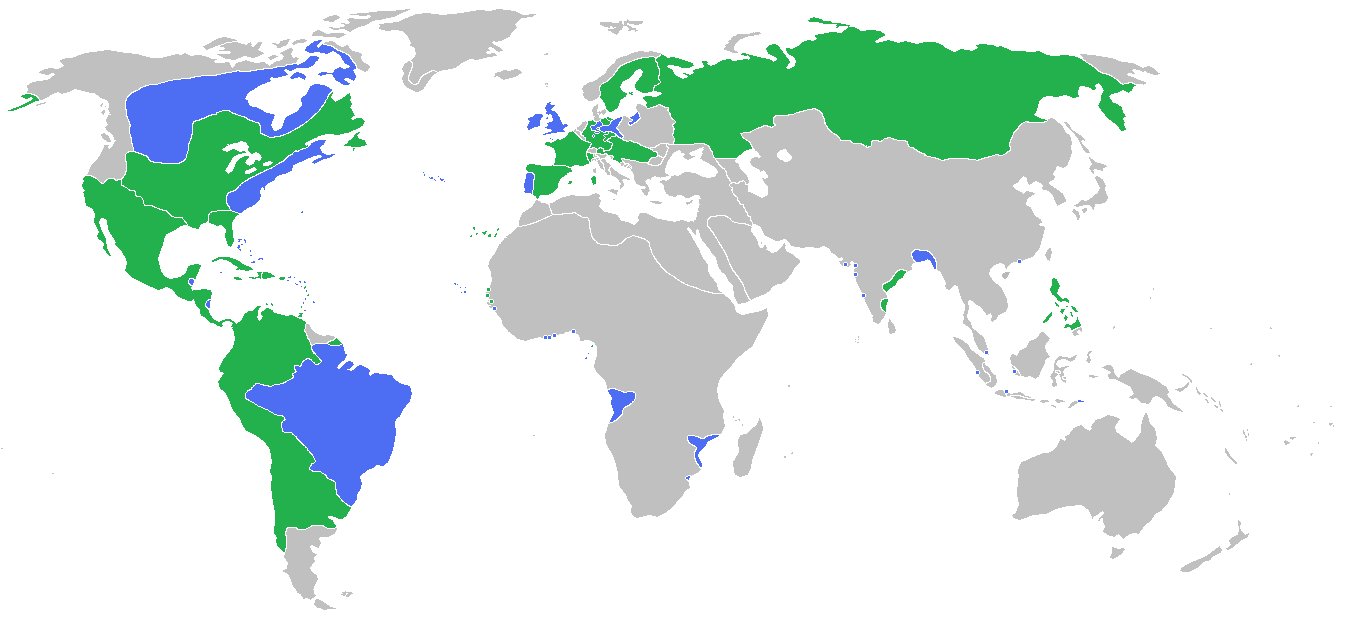
Locator map of the competing sides of the Seven Years War before outset of the war (mid-1750s).
(Partially based on Atlas of World History (2007) - There was also a treaty in 1783, Imperialism and Revolutions, map)
Blue: Great Britain, Portugal with more. Green: France, Spain with more.
Great Britain, Prussia, Portugal, with allies
France, Spain, Austria, Russia, Sweden with allies
Français : Carte montrant les forces en présence lors de la guerre de Sept Ans (milieu des années 1750).
Grande Bretagne, Prusse, Portugal, leurs alliés et dépendances
France, Espagne, Autriche, Russie, Suède, leurs alliés et dépendances
(Partially based on Atlas of World History (2007) - There was also a treaty in 1783, Imperialism and Revolutions, map)
Licencja:
Warunki licencji:
Creative Commons Attribution 3.0
Więcej informacji o licencji można znaleźć tutaj. Ostatnia aktualizacja: Fri, 30 Dec 2022 16:03:27 GMT