T and O map Guntherus Ziner 1472
Autor:
Isidore of Seville
Credit:
Ten plik jest fragmentem innego pliku
Krótki link:
źródło:
Wymiary:
864 x 864 Pixel (285884 Bytes)
Opis:
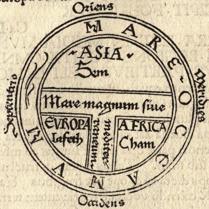
- T and O style mappa mundi (map of the known world) from the first printed version of Isidorus' Etymologiae (Kraus 13). The book was written in 623 and first printed in 1472 at Augsburg by one Günther Zainer (Guntherus Ziner), Isidor's sketch thus becoming the oldest printed map of the occident.
- Note: T-O-maps are typically displayed "East-up", show Jerusalem at the center and the paradise at the outmost East, balanced by the pillars of Hercules at the outmost West.
Licencja:
Public domain
Więcej informacji o licencji można znaleźć tutaj. Ostatnia aktualizacja: Wed, 09 Nov 2022 21:59:12 GMT