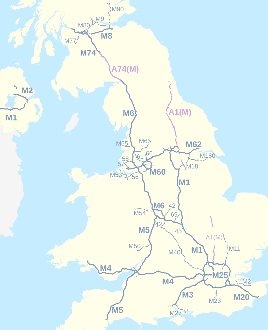
UK motorways map 2016
Nilfanion and Dr Greg. © OpenStreetMap contributors. Contains Ordnance Survey data © Crown copyright and database right 2010., CC BY-SA 4.0
Autor:
- A38 UK road map.svg: Nilfanion, created using Ordnance Survey data
- Stirling UK location map.svg: Nilfanion, created using Ordnance Survey data
- Fife UK location map.svg: Nilfanion, created using Ordnance Survey data
- Glasgow UK location map.svg: Nilfanion, created using Ordnance Survey data
- Scottish council areas 2011.svg: Nilfanion, created using Ordnance Survey data
- North Yorkshire UK location map.svg: Nilfanion, created using Ordnance Survey data
- OpenStreetMap: OpenStreetMap contributors
- derivative work: Dr Greg
Credit:
Ten plik jest pochodną pracą:
-
 A38 UK road map.svg
-
 Stirling UK location map.svg
-
 Fife UK location map.svg
-
 Glasgow UK location map.svg
-
 Scottish council areas 2011.svg
-
 North Yorkshire UK location map.svg
- OpenStreetMap for Northern Ireland motorways: http://www.openstreetmap.org/#map=8/54.687/-5.606 2016-02-21
Krótki link:
źródło:
Wymiary:
1038 x 1279 Pixel (525375 Bytes)
Opis:
Map of the motorways of the United Kingdom in 2016. The shortest motorways are not labelled. Motorways in Northern Ireland are numbered independently from motorways in Great Britain.
Equirectangular map projection on WGS 84 datum.
- Key
M-designated motorway
under construction
Upgraded A-road designation
under reconstruction
Licencja:
Warunki licencji:
Creative Commons Attribution-Share Alike 4.0
Więcej informacji o licencji można znaleźć tutaj. Ostatnia aktualizacja: Wed, 24 Aug 2022 01:53:56 GMT
