Latzina1888
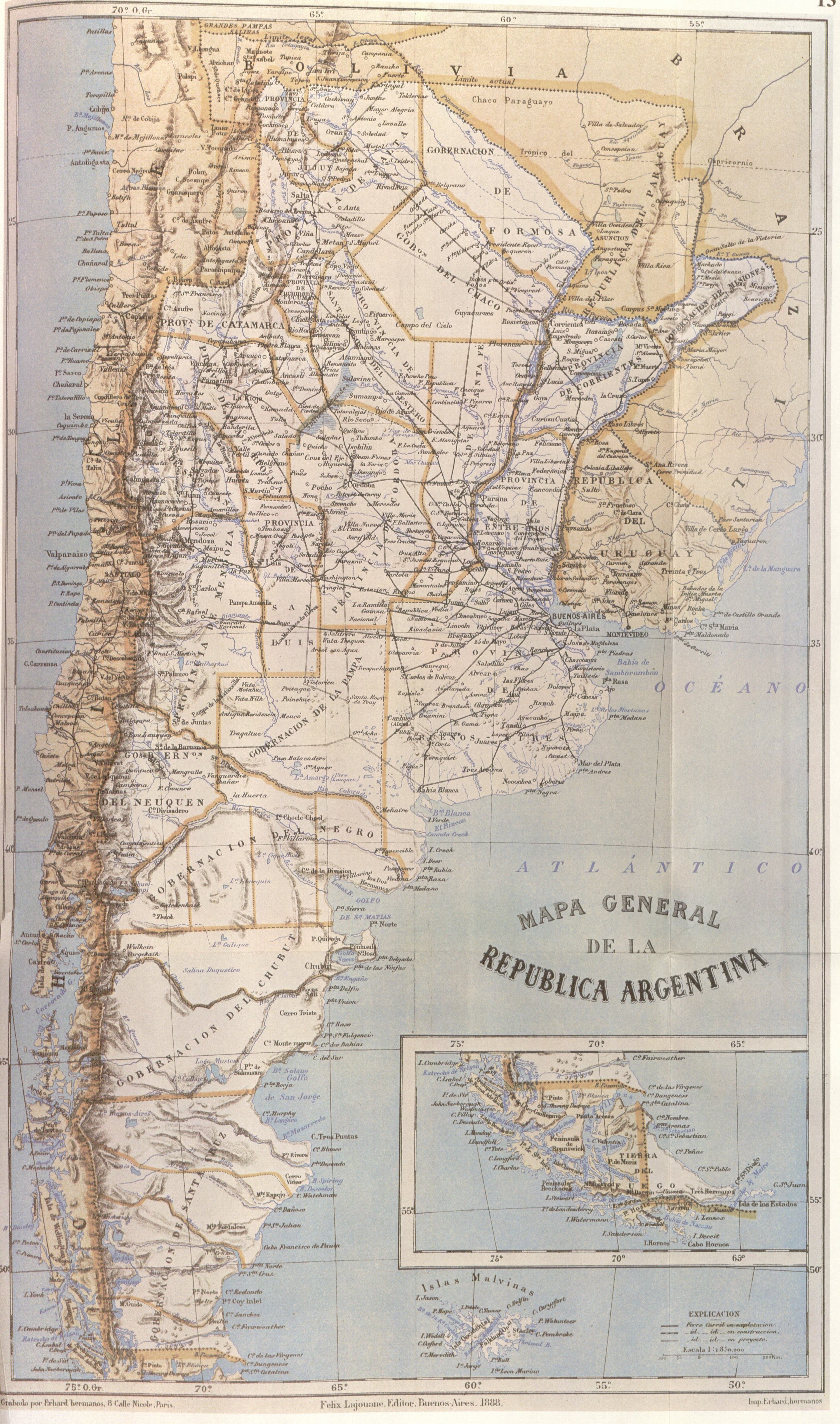
"This map, partially reproduced here, is included in the Geography of the Argentine Republic published in Buenos Aires in 1888 by Francisco Latzina, National Director of the Argentine Statistics and member of numerous scientific societies.
In the extreme southern region, the international boundary is traced along the centre of the Beagle Channel and stretches to the south of the Isla de los Estados. Here it shows Picton, Nueva and Lennox Islands and all other islands and islets extending southward as far as Cape Horn as being undr Chilean sovereignty."|
Ten materiał przeszedł do domeny publicznej w kraju pochodzenia, jak również w państwach i terytoriach, gdzie prawo autorskie wygasa w ciągu 70 lat po śmierci autora.
| |
| Plik rozpoznano jako wolny od znanych ograniczeń praw autorskich, włącznie z prawami zależnymi i pokrewnymi. | |
Więcej informacji o licencji można znaleźć tutaj. Ostatnia aktualizacja: Sun, 18 Dec 2022 16:24:18 GMT